You are here: Home > Network List > US - United States National Seismic Network Stations List
> Station AMTX Amarillo, Texas, USA > Earthquake Result Viewer
AMTX Amarillo, Texas, USA - Earthquake Result Viewer
*The percent match for this event was below the threshold and hence no stack was calculated.
| Earthquake location: |
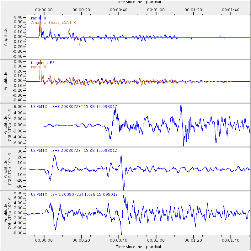
Eastern Honshu, Japan |
| Earthquake latitude/longitude: |
39.8/141.5 |
| Earthquake time(UTC): |
2008/07/23 (205) 15:26:19 GMT |
| Earthquake Depth: |
108 km |
| Earthquake Magnitude: |
6.6 MB, 6.8 MW, 6.8 MW |
| Earthquake Catalog/Contributor: |
WHDF/NEIC |
|
| Network: |
US United States National Seismic Network |
| Station: |
AMTX Amarillo, Texas, USA |
| Lat/Lon: |
34.53 N/101.41 W |
| Elevation: |
1010 m |
|
| Distance: |
86.0 deg |
| Az: |
47.44 deg |
| Baz: |
316.583 deg |
| Ray Param: |
$rayparam |
*The percent match for this event was below the threshold and hence was not used in the summary stack. |
|
| Radial Match: |
97.72792 % |
| Radial Bump: |
400 |
| Transverse Match: |
92.204 % |
| Transverse Bump: |
400 |
| SOD ConfigId: |
2504 |
| Insert Time: |
2010-03-05 03:04:28.704 +0000 |
| GWidth: |
2.5 |
| Max Bumps: |
400 |
| Tol: |
0.001 |
|
Signal To Noise
| Channel | StoN | STA | LTA |
| US:AMTX: :BHZ:20080723T15:38:15.09801Z | 26.344934 | 8.126409E-6 | 3.0846192E-7 |
| US:AMTX: :BHN:20080723T15:38:15.09801Z | 8.088531 | 1.8583022E-6 | 2.2974535E-7 |
| US:AMTX: :BHE:20080723T15:38:15.09801Z | 7.2399535 | 1.954634E-6 | 2.699788E-7 |
| Arrivals |
| Ps | |
| PpPs | |
| PsPs/PpSs | |


