You are here: Home > Network List > US - United States National Seismic Network Stations List
> Station AMTX Amarillo, Texas, USA > Earthquake Result Viewer
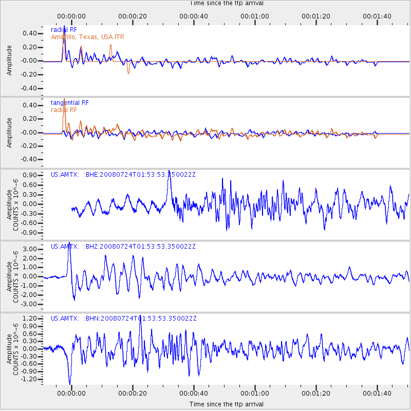
AMTX Amarillo, Texas, USA - Earthquake Result Viewer
*The percent match for this event was below the threshold and hence no stack was calculated.
| Earthquake location: |
Kuril Islands |
| Earthquake latitude/longitude: |
51.0/157.6 |
| Earthquake time(UTC): |
2008/07/24 (206) 01:43:16 GMT |
| Earthquake Depth: |
27 km |
| Earthquake Magnitude: |
6.0 MB, 6.0 MS, 6.2 MW, 6.2 MW |
| Earthquake Catalog/Contributor: |
WHDF/NEIC |
|
| Network: |
US United States National Seismic Network |
| Station: |
AMTX Amarillo, Texas, USA |
| Lat/Lon: |
34.53 N/101.41 W |
| Elevation: |
1010 m |
|
| Distance: |
70.3 deg |
| Az: |
59.419 deg |
| Baz: |
318.749 deg |
| Ray Param: |
$rayparam |
*The percent match for this event was below the threshold and hence was not used in the summary stack. |
|
| Radial Match: |
89.033585 % |
| Radial Bump: |
400 |
| Transverse Match: |
65.34873 % |
| Transverse Bump: |
400 |
| SOD ConfigId: |
2504 |
| Insert Time: |
2010-03-05 03:04:30.067 +0000 |
| GWidth: |
2.5 |
| Max Bumps: |
400 |
| Tol: |
0.001 |
|
Signal To Noise
| Channel | StoN | STA | LTA |
| US:AMTX: :BHZ:20080724T01:53:53.350022Z | 12.251548 | 1.6238184E-6 | 1.3253987E-7 |
| US:AMTX: :BHN:20080724T01:53:53.350022Z | 5.382627 | 5.7666153E-7 | 1.0713384E-7 |
| US:AMTX: :BHE:20080724T01:53:53.350022Z | 2.948615 | 4.5787667E-7 | 1.5528533E-7 |
| Arrivals |
| Ps | |
| PpPs | |
| PsPs/PpSs | |


