You are here: Home > Network List > CI - Caltech Regional Seismic Network Stations List
> Station LRL Laurel Mtn Radio Fac, Ridgecrest, CA, USA > Earthquake Result Viewer
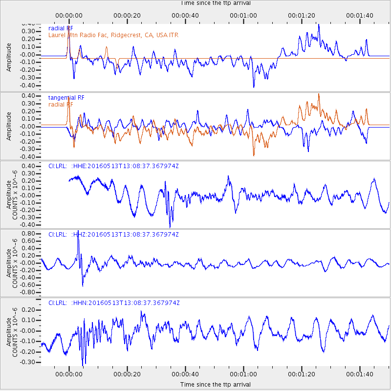
LRL Laurel Mtn Radio Fac, Ridgecrest, CA, USA - Earthquake Result Viewer
*The percent match for this event was below the threshold and hence no stack was calculated.
| Earthquake location: |
South Of Fiji Islands |
| Earthquake latitude/longitude: |
-25.5/179.3 |
| Earthquake time(UTC): |
2016/05/13 (134) 12:57:27 GMT |
| Earthquake Depth: |
506 km |
| Earthquake Magnitude: |
5.6 MWW |
| Earthquake Catalog/Contributor: |
NEIC PDE/NEIC COMCAT |
|
| Network: |
CI Caltech Regional Seismic Network |
| Station: |
LRL Laurel Mtn Radio Fac, Ridgecrest, CA, USA |
| Lat/Lon: |
35.48 N/117.68 W |
| Elevation: |
1340 m |
|
| Distance: |
85.0 deg |
| Az: |
46.877 deg |
| Baz: |
233.93 deg |
| Ray Param: |
$rayparam |
*The percent match for this event was below the threshold and hence was not used in the summary stack. |
|
| Radial Match: |
46.70081 % |
| Radial Bump: |
400 |
| Transverse Match: |
68.61627 % |
| Transverse Bump: |
400 |
| SOD ConfigId: |
7422571 |
| Insert Time: |
2019-04-22 14:00:47.281 +0000 |
| GWidth: |
2.5 |
| Max Bumps: |
400 |
| Tol: |
0.001 |
|
Signal To Noise
| Channel | StoN | STA | LTA |
| CI:LRL: :HHZ:20160513T13:08:37.367974Z | 3.803943 | 2.844137E-7 | 7.476813E-8 |
| CI:LRL: :HHN:20160513T13:08:37.367974Z | 1.2788826 | 2.1451706E-7 | 1.6773788E-7 |
| CI:LRL: :HHE:20160513T13:08:37.367974Z | 1.5427905 | 2.1294784E-7 | 1.380277E-7 |
| Arrivals |
| Ps | |
| PpPs | |
| PsPs/PpSs | |


