You are here: Home > Network List > US - United States National Seismic Network Stations List
> Station CBKS Cedar Bluff, Kansas, USA > Earthquake Result Viewer
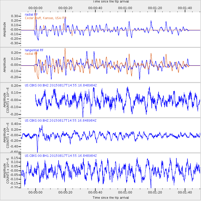
CBKS Cedar Bluff, Kansas, USA - Earthquake Result Viewer
*The percent match for this event was below the threshold and hence no stack was calculated.
| Earthquake location: |
Mariana Islands Region |
| Earthquake latitude/longitude: |
21.9/146.6 |
| Earthquake time(UTC): |
2015/08/17 (229) 14:42:32 GMT |
| Earthquake Depth: |
3.1 km |
| Earthquake Magnitude: |
5.6 MWB |
| Earthquake Catalog/Contributor: |
NEIC PDE/NEIC COMCAT |
|
| Network: |
US United States National Seismic Network |
| Station: |
CBKS Cedar Bluff, Kansas, USA |
| Lat/Lon: |
38.81 N/99.74 W |
| Elevation: |
677 m |
|
| Distance: |
93.4 deg |
| Az: |
45.81 deg |
| Baz: |
301.549 deg |
| Ray Param: |
$rayparam |
*The percent match for this event was below the threshold and hence was not used in the summary stack. |
|
| Radial Match: |
57.19455 % |
| Radial Bump: |
400 |
| Transverse Match: |
68.48297 % |
| Transverse Bump: |
400 |
| SOD ConfigId: |
1085051 |
| Insert Time: |
2015-08-31 15:13:46.048 +0000 |
| GWidth: |
2.5 |
| Max Bumps: |
400 |
| Tol: |
0.001 |
|
Signal To Noise
| Channel | StoN | STA | LTA |
| US:CBKS:00:BHZ:20150817T14:55:16.848984Z | 2.615691 | 2.1213215E-7 | 8.109985E-8 |
| US:CBKS:00:BH1:20150817T14:55:16.848984Z | 0.99181795 | 5.568907E-8 | 5.614848E-8 |
| US:CBKS:00:BH2:20150817T14:55:16.848984Z | 1.3485217 | 8.182983E-8 | 6.068114E-8 |
| Arrivals |
| Ps | |
| PpPs | |
| PsPs/PpSs | |


