You are here: Home > Network List > US - United States National Seismic Network Stations List
> Station AMTX Amarillo, Texas, USA > Earthquake Result Viewer
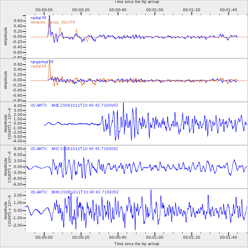
AMTX Amarillo, Texas, USA - Earthquake Result Viewer
*The percent match for this event was below the threshold and hence no stack was calculated.
| Earthquake location: |
Virgin Islands |
| Earthquake latitude/longitude: |
19.2/-64.8 |
| Earthquake time(UTC): |
2008/10/11 (285) 10:40:14 GMT |
| Earthquake Depth: |
23 km |
| Earthquake Magnitude: |
6.1 MB, 5.9 MS, 6.1 MW, 6.0 MW |
| Earthquake Catalog/Contributor: |
WHDF/NEIC |
|
| Network: |
US United States National Seismic Network |
| Station: |
AMTX Amarillo, Texas, USA |
| Lat/Lon: |
34.53 N/101.41 W |
| Elevation: |
1010 m |
|
| Distance: |
35.8 deg |
| Az: |
302.801 deg |
| Baz: |
105.762 deg |
| Ray Param: |
$rayparam |
*The percent match for this event was below the threshold and hence was not used in the summary stack. |
|
| Radial Match: |
86.795715 % |
| Radial Bump: |
400 |
| Transverse Match: |
59.69526 % |
| Transverse Bump: |
400 |
| SOD ConfigId: |
2556 |
| Insert Time: |
2010-03-05 03:04:50.500 +0000 |
| GWidth: |
2.5 |
| Max Bumps: |
400 |
| Tol: |
0.001 |
|
Signal To Noise
| Channel | StoN | STA | LTA |
| US:AMTX: :BHZ:20081011T10:46:43.716006Z | 3.6101797 | 1.4663611E-6 | 4.06174E-7 |
| US:AMTX: :BHN:20081011T10:46:43.716006Z | 1.9439383 | 4.922087E-7 | 2.532018E-7 |
| US:AMTX: :BHE:20081011T10:46:43.716006Z | 3.736262 | 5.810831E-7 | 1.5552526E-7 |
| Arrivals |
| Ps | |
| PpPs | |
| PsPs/PpSs | |


