You are here: Home > Network List > US - United States National Seismic Network Stations List
> Station DUG Dugway, Tooele County, Utah, USA > Earthquake Result Viewer
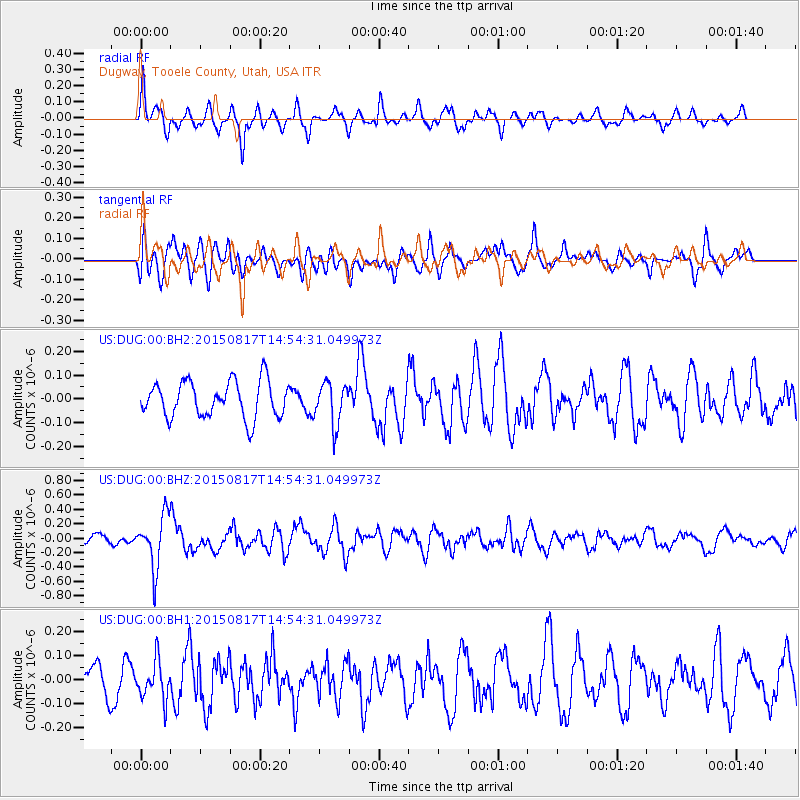
DUG Dugway, Tooele County, Utah, USA - Earthquake Result Viewer
*The percent match for this event was below the threshold and hence no stack was calculated.
| Earthquake location: |
Mariana Islands Region |
| Earthquake latitude/longitude: |
21.9/146.6 |
| Earthquake time(UTC): |
2015/08/17 (229) 14:42:32 GMT |
| Earthquake Depth: |
3.1 km |
| Earthquake Magnitude: |
5.6 MWB |
| Earthquake Catalog/Contributor: |
NEIC PDE/NEIC COMCAT |
|
| Network: |
US United States National Seismic Network |
| Station: |
DUG Dugway, Tooele County, Utah, USA |
| Lat/Lon: |
40.19 N/112.81 W |
| Elevation: |
1477 m |
|
| Distance: |
83.8 deg |
| Az: |
49.247 deg |
| Baz: |
293.328 deg |
| Ray Param: |
$rayparam |
*The percent match for this event was below the threshold and hence was not used in the summary stack. |
|
| Radial Match: |
70.35522 % |
| Radial Bump: |
400 |
| Transverse Match: |
69.95707 % |
| Transverse Bump: |
400 |
| SOD ConfigId: |
1085051 |
| Insert Time: |
2015-08-31 15:13:53.992 +0000 |
| GWidth: |
2.5 |
| Max Bumps: |
400 |
| Tol: |
0.001 |
|
Signal To Noise
| Channel | StoN | STA | LTA |
| US:DUG:00:BHZ:20150817T14:54:31.049973Z | 5.8137517 | 3.6257597E-7 | 6.236523E-8 |
| US:DUG:00:BH1:20150817T14:54:31.049973Z | 1.7848299 | 8.0265956E-8 | 4.497121E-8 |
| US:DUG:00:BH2:20150817T14:54:31.049973Z | 1.1530856 | 8.746461E-8 | 7.585266E-8 |
| Arrivals |
| Ps | |
| PpPs | |
| PsPs/PpSs | |


