You are here: Home > Network List > TA - USArray Transportable Network (new EarthScope stations) Stations List
> Station J01E Myrtle Point, OR, USA > Earthquake Result Viewer
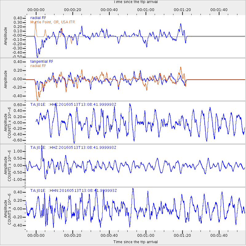
J01E Myrtle Point, OR, USA - Earthquake Result Viewer
*The percent match for this event was below the threshold and hence no stack was calculated.
| Earthquake location: |
South Of Fiji Islands |
| Earthquake latitude/longitude: |
-25.5/179.3 |
| Earthquake time(UTC): |
2016/05/13 (134) 12:57:27 GMT |
| Earthquake Depth: |
506 km |
| Earthquake Magnitude: |
5.6 MWW |
| Earthquake Catalog/Contributor: |
NEIC PDE/NEIC COMCAT |
|
| Network: |
TA USArray Transportable Network (new EarthScope stations) |
| Station: |
J01E Myrtle Point, OR, USA |
| Lat/Lon: |
43.16 N/123.93 W |
| Elevation: |
128 m |
|
| Distance: |
85.9 deg |
| Az: |
37.831 deg |
| Baz: |
229.253 deg |
| Ray Param: |
$rayparam |
*The percent match for this event was below the threshold and hence was not used in the summary stack. |
|
| Radial Match: |
42.278606 % |
| Radial Bump: |
400 |
| Transverse Match: |
52.68924 % |
| Transverse Bump: |
400 |
| SOD ConfigId: |
7422571 |
| Insert Time: |
2019-04-22 14:02:56.728 +0000 |
| GWidth: |
2.5 |
| Max Bumps: |
400 |
| Tol: |
0.001 |
|
Signal To Noise
| Channel | StoN | STA | LTA |
| TA:J01E: :HHZ:20160513T13:08:41.999993Z | 2.1944675 | 4.3985105E-7 | 2.0043635E-7 |
| TA:J01E: :HHN:20160513T13:08:41.999993Z | 0.8968315 | 1.8836421E-7 | 2.10033E-7 |
| TA:J01E: :HHE:20160513T13:08:41.999993Z | 1.1701778 | 3.151983E-7 | 2.6935933E-7 |
| Arrivals |
| Ps | |
| PpPs | |
| PsPs/PpSs | |


