You are here: Home > Network List > US - United States National Seismic Network Stations List
> Station EGMT Eagleton, Montana, USA > Earthquake Result Viewer
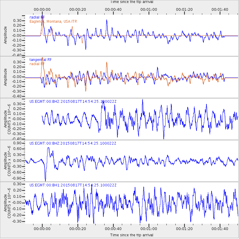
EGMT Eagleton, Montana, USA - Earthquake Result Viewer
*The percent match for this event was below the threshold and hence no stack was calculated.
| Earthquake location: |
Mariana Islands Region |
| Earthquake latitude/longitude: |
21.9/146.6 |
| Earthquake time(UTC): |
2015/08/17 (229) 14:42:32 GMT |
| Earthquake Depth: |
3.1 km |
| Earthquake Magnitude: |
5.6 MWB |
| Earthquake Catalog/Contributor: |
NEIC PDE/NEIC COMCAT |
|
| Network: |
US United States National Seismic Network |
| Station: |
EGMT Eagleton, Montana, USA |
| Lat/Lon: |
48.02 N/109.75 W |
| Elevation: |
1055 m |
|
| Distance: |
82.6 deg |
| Az: |
41.143 deg |
| Baz: |
294.492 deg |
| Ray Param: |
$rayparam |
*The percent match for this event was below the threshold and hence was not used in the summary stack. |
|
| Radial Match: |
78.08658 % |
| Radial Bump: |
400 |
| Transverse Match: |
65.17298 % |
| Transverse Bump: |
400 |
| SOD ConfigId: |
1085051 |
| Insert Time: |
2015-08-31 15:14:06.520 +0000 |
| GWidth: |
2.5 |
| Max Bumps: |
400 |
| Tol: |
0.001 |
|
Signal To Noise
| Channel | StoN | STA | LTA |
| US:EGMT:00:BHZ:20150817T14:54:25.100022Z | 5.7084823 | 4.4181738E-7 | 7.739665E-8 |
| US:EGMT:00:BH1:20150817T14:54:25.100022Z | 1.181266 | 9.791389E-8 | 8.288894E-8 |
| US:EGMT:00:BH2:20150817T14:54:25.100022Z | 2.5049305 | 1.9251556E-7 | 7.6854654E-8 |
| Arrivals |
| Ps | |
| PpPs | |
| PsPs/PpSs | |


