You are here: Home > Network List > US - United States National Seismic Network Stations List
> Station AMTX Amarillo, Texas, USA > Earthquake Result Viewer
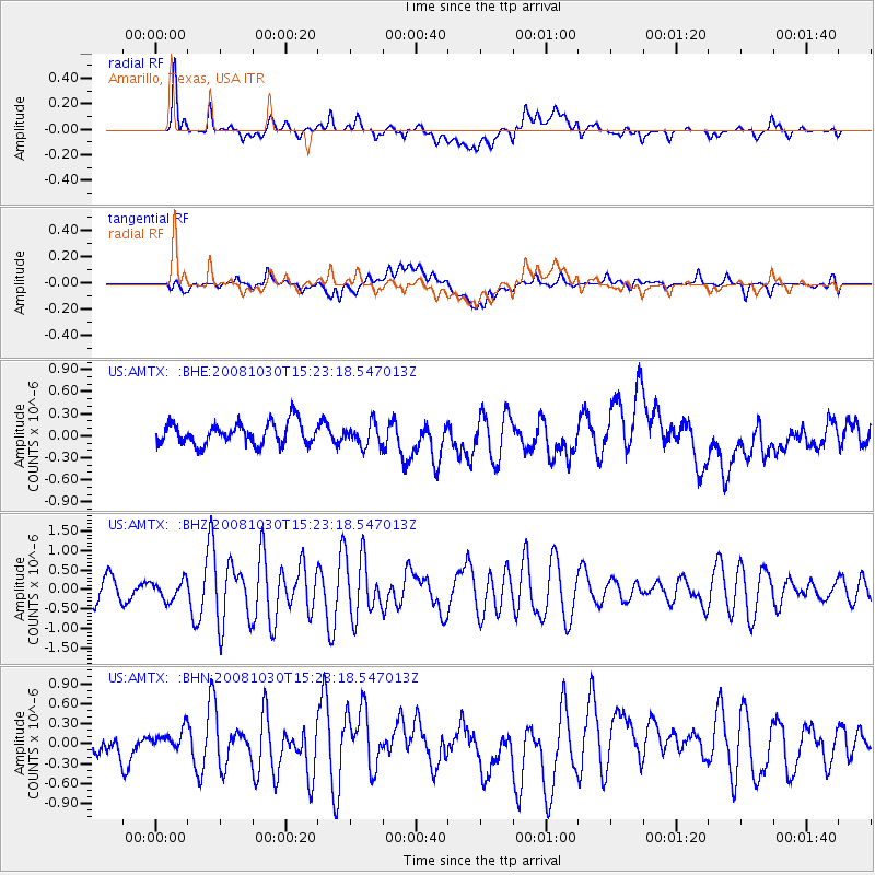
AMTX Amarillo, Texas, USA - Earthquake Result Viewer
*The percent match for this event was below the threshold and hence no stack was calculated.
| Earthquake location: |
Central East Pacific Rise |
| Earthquake latitude/longitude: |
-9.0/-108.2 |
| Earthquake time(UTC): |
2008/10/30 (304) 15:15:41 GMT |
| Earthquake Depth: |
10 km |
| Earthquake Magnitude: |
5.5 MB, 5.8 MS, 6.0 MW, 6.0 MW |
| Earthquake Catalog/Contributor: |
WHDF/NEIC |
|
| Network: |
US United States National Seismic Network |
| Station: |
AMTX Amarillo, Texas, USA |
| Lat/Lon: |
34.53 N/101.41 W |
| Elevation: |
1010 m |
|
| Distance: |
43.8 deg |
| Az: |
8.165 deg |
| Baz: |
189.784 deg |
| Ray Param: |
$rayparam |
*The percent match for this event was below the threshold and hence was not used in the summary stack. |
|
| Radial Match: |
64.53523 % |
| Radial Bump: |
400 |
| Transverse Match: |
39.854748 % |
| Transverse Bump: |
400 |
| SOD ConfigId: |
2560 |
| Insert Time: |
2010-03-05 03:05:03.409 +0000 |
| GWidth: |
2.5 |
| Max Bumps: |
400 |
| Tol: |
0.001 |
|
Signal To Noise
| Channel | StoN | STA | LTA |
| US:AMTX: :BHZ:20081030T15:23:18.547013Z | 1.1190583 | 2.452384E-7 | 2.1914711E-7 |
| US:AMTX: :BHN:20081030T15:23:18.547013Z | 0.8002818 | 1.4225293E-7 | 1.7775355E-7 |
| US:AMTX: :BHE:20081030T15:23:18.547013Z | 0.8243354 | 1.2546084E-7 | 1.5219635E-7 |
| Arrivals |
| Ps | |
| PpPs | |
| PsPs/PpSs | |


