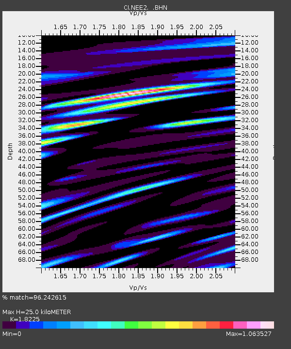
NEE2 Needles Airport - Earthquake Result Viewer
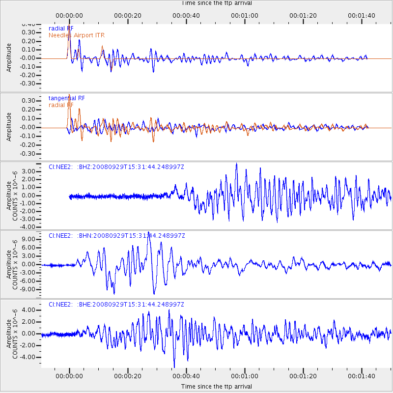
Earthquake location: Kermadec Islands, New Zealand
Earthquake latitude/longitude: -29.8/-177.7
Earthquake time(UTC): 2008/09/29 (273) 15:19:31 GMT
Earthquake Depth: 36 km
Earthquake Magnitude: 6.5 MB, 6.7 MS, 7.0 MW, 7.0 MW
Earthquake Catalog/Contributor: WHDF/NEIC
Network: CI Caltech Regional Seismic Network
Station: NEE2 Needles Airport
Lat/Lon: 34.77 N/114.62 W
Elevation: 271 m
Distance: 87.5 deg
Az: 47.278 deg
Baz: 230.895 deg
Ray Param: 0.04324971
Estimated Moho Depth: 25.0 km
Estimated Crust Vp/Vs: 1.82
Assumed Crust Vp: 6.276 km/s
Estimated Crust Vs: 3.444 km/s
Estimated Crust Poisson's Ratio: 0.28
Radial Match: 96.242615 %
Radial Bump: 400
Transverse Match: 94.21099 %
Transverse Bump: 400
SOD ConfigId: 2560
Insert Time: 2010-02-26 00:21:40.904 +0000
GWidth: 2.5
Max Bumps: 400
Tol: 0.001

Signal To Noise

ChannelStoNSTALTA
CI:NEE2: :BHN:20080929T15:31:44.248997Z5.8322058.001251E-71.3719084E-7
CI:NEE2: :BHE:20080929T15:31:44.248997Z2.06578682.7984555E-71.354668E-7
CI:NEE2: :BHZ:20080929T15:31:44.248997Z1.34605872.0184613E-71.4995344E-7
Arrivals
Ps3.3 SECOND
PpPs11 SECOND
PsPs/PpSs14 SECOND