You are here: Home > Network List > US - United States National Seismic Network Stations List
> Station AMTX Amarillo, Texas, USA > Earthquake Result Viewer
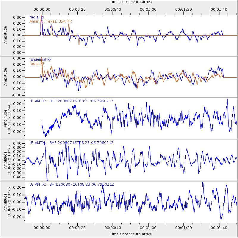
AMTX Amarillo, Texas, USA - Earthquake Result Viewer
*The percent match for this event was below the threshold and hence no stack was calculated.
| Earthquake location: |
Samoa Islands Region |
| Earthquake latitude/longitude: |
-16.6/-173.0 |
| Earthquake time(UTC): |
2008/07/16 (198) 08:11:04 GMT |
| Earthquake Depth: |
10 km |
| Earthquake Magnitude: |
5.5 MB, 5.4 MS, 5.7 MW, 5.7 MW |
| Earthquake Catalog/Contributor: |
WHDF/NEIC |
|
| Network: |
US United States National Seismic Network |
| Station: |
AMTX Amarillo, Texas, USA |
| Lat/Lon: |
34.53 N/101.41 W |
| Elevation: |
1010 m |
|
| Distance: |
84.8 deg |
| Az: |
51.85 deg |
| Baz: |
245.968 deg |
| Ray Param: |
$rayparam |
*The percent match for this event was below the threshold and hence was not used in the summary stack. |
|
| Radial Match: |
62.536102 % |
| Radial Bump: |
400 |
| Transverse Match: |
37.713184 % |
| Transverse Bump: |
400 |
| SOD ConfigId: |
2504 |
| Insert Time: |
2010-03-05 03:05:14.422 +0000 |
| GWidth: |
2.5 |
| Max Bumps: |
400 |
| Tol: |
0.001 |
|
Signal To Noise
| Channel | StoN | STA | LTA |
| US:AMTX: :BHZ:20080716T08:23:06.796021Z | 3.027214 | 2.3321255E-7 | 7.703867E-8 |
| US:AMTX: :BHN:20080716T08:23:06.796021Z | 0.78340924 | 7.4986154E-8 | 9.571774E-8 |
| US:AMTX: :BHE:20080716T08:23:06.796021Z | 0.6687424 | 7.6619855E-8 | 1.1457305E-7 |
| Arrivals |
| Ps | |
| PpPs | |
| PsPs/PpSs | |


