You are here: Home > Network List > US - United States National Seismic Network Stations List
> Station AMTX Amarillo, Texas, USA > Earthquake Result Viewer
AMTX Amarillo, Texas, USA - Earthquake Result Viewer
*The percent match for this event was below the threshold and hence no stack was calculated.
| Earthquake location: |
Southeast Of Honshu, Japan |
| Earthquake latitude/longitude: |
32.8/140.4 |
| Earthquake time(UTC): |
2009/08/12 (224) 22:48:51 GMT |
| Earthquake Depth: |
53 km |
| Earthquake Magnitude: |
6.2 MB, 6.6 MW, 6.6 MW |
| Earthquake Catalog/Contributor: |
WHDF/NEIC |
|
| Network: |
US United States National Seismic Network |
| Station: |
AMTX Amarillo, Texas, USA |
| Lat/Lon: |
34.53 N/101.41 W |
| Elevation: |
1010 m |
|
| Distance: |
91.4 deg |
| Az: |
46.705 deg |
| Baz: |
312.071 deg |
| Ray Param: |
$rayparam |
*The percent match for this event was below the threshold and hence was not used in the summary stack. |
|
| Radial Match: |
82.3405 % |
| Radial Bump: |
400 |
| Transverse Match: |
82.72725 % |
| Transverse Bump: |
400 |
| SOD ConfigId: |
2622 |
| Insert Time: |
2010-03-05 03:05:21.199 +0000 |
| GWidth: |
2.5 |
| Max Bumps: |
400 |
| Tol: |
0.001 |
|
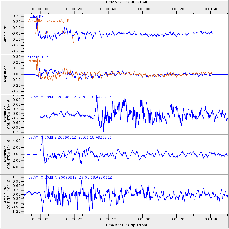
Signal To Noise
| Channel | StoN | STA | LTA |
| US:AMTX:00:BHZ:20090812T23:01:18.492021Z | 32.340385 | 2.2609465E-6 | 6.991094E-8 |
| US:AMTX:00:BHN:20090812T23:01:18.492021Z | 3.8893251 | 4.994748E-7 | 1.2842197E-7 |
| US:AMTX:00:BHE:20090812T23:01:18.492021Z | 5.299288 | 5.5122104E-7 | 1.0401795E-7 |
| Arrivals |
| Ps | |
| PpPs | |
| PsPs/PpSs | |


