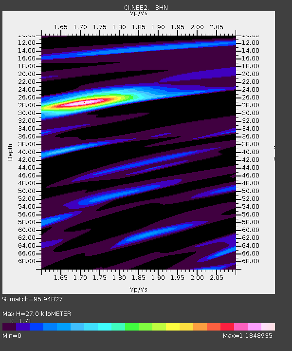
NEE2 Needles Airport - Earthquake Result Viewer
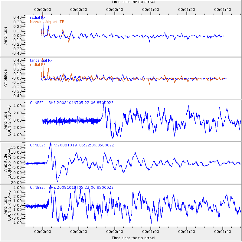
Earthquake location: Tonga Islands
Earthquake latitude/longitude: -21.9/-173.8
Earthquake time(UTC): 2008/10/19 (293) 05:10:33 GMT
Earthquake Depth: 29 km
Earthquake Magnitude: 6.8 MB, 7.0 MS, 6.9 MW, 6.9 MW
Earthquake Catalog/Contributor: WHDF/NEIC
Network: CI Caltech Regional Seismic Network
Station: NEE2 Needles Airport
Lat/Lon: 34.77 N/114.62 W
Elevation: 271 m
Distance: 79.5 deg
Az: 45.979 deg
Baz: 234.231 deg
Ray Param: 0.04884851
Estimated Moho Depth: 27.0 km
Estimated Crust Vp/Vs: 1.71
Assumed Crust Vp: 6.276 km/s
Estimated Crust Vs: 3.67 km/s
Estimated Crust Poisson's Ratio: 0.24
Radial Match: 95.94827 %
Radial Bump: 334
Transverse Match: 90.119675 %
Transverse Bump: 400
SOD ConfigId: 2560
Insert Time: 2010-02-26 00:21:42.618 +0000
GWidth: 2.5
Max Bumps: 400
Tol: 0.001

Signal To Noise

ChannelStoNSTALTA
CI:NEE2: :BHN:20081019T05:22:06.850002Z24.3034958.558266E-63.5214137E-7
CI:NEE2: :BHE:20081019T05:22:06.850002Z6.43415071.8399271E-62.859627E-7
CI:NEE2: :BHZ:20081019T05:22:06.850002Z5.3902162.2173922E-64.1137355E-7
Arrivals
Ps3.1 SECOND
PpPs11 SECOND
PsPs/PpSs14 SECOND