You are here: Home > Network List > US - United States National Seismic Network Stations List
> Station AMTX Amarillo, Texas, USA > Earthquake Result Viewer
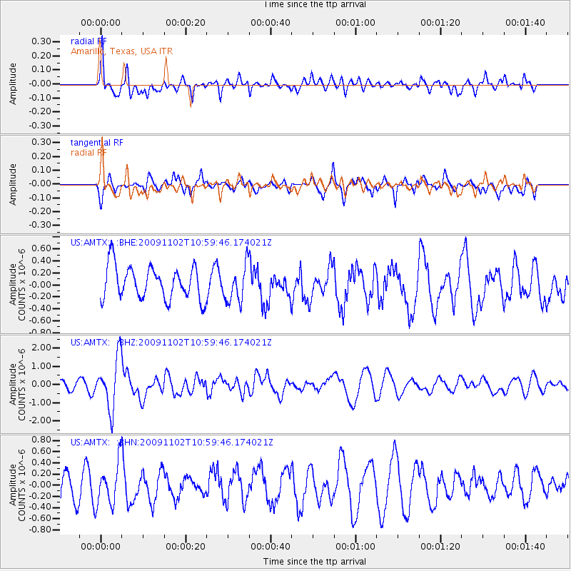
AMTX Amarillo, Texas, USA - Earthquake Result Viewer
*The percent match for this event was below the threshold and hence no stack was calculated.
| Earthquake location: |
South Of Tonga Islands |
| Earthquake latitude/longitude: |
-24.1/-175.2 |
| Earthquake time(UTC): |
2009/11/02 (306) 10:47:13 GMT |
| Earthquake Depth: |
9.0 km |
| Earthquake Magnitude: |
6.1 MB, 6.1 MS, 6.2 MW, 6.1 MW |
| Earthquake Catalog/Contributor: |
WHDF/NEIC |
|
| Network: |
US United States National Seismic Network |
| Station: |
AMTX Amarillo, Texas, USA |
| Lat/Lon: |
34.53 N/101.41 W |
| Elevation: |
1010 m |
|
| Distance: |
91.1 deg |
| Az: |
52.449 deg |
| Baz: |
241.332 deg |
| Ray Param: |
$rayparam |
*The percent match for this event was below the threshold and hence was not used in the summary stack. |
|
| Radial Match: |
57.55254 % |
| Radial Bump: |
383 |
| Transverse Match: |
50.730034 % |
| Transverse Bump: |
400 |
| SOD ConfigId: |
2622 |
| Insert Time: |
2010-03-05 03:05:26.354 +0000 |
| GWidth: |
2.5 |
| Max Bumps: |
400 |
| Tol: |
0.001 |
|
Signal To Noise
| Channel | StoN | STA | LTA |
| US:AMTX: :BHZ:20091102T10:59:46.174021Z | 6.350258 | 1.4344786E-6 | 2.2589296E-7 |
| US:AMTX: :BHN:20091102T10:59:46.174021Z | 1.2970923 | 3.6165278E-7 | 2.7881808E-7 |
| US:AMTX: :BHE:20091102T10:59:46.174021Z | 1.1586572 | 3.1621798E-7 | 2.7291765E-7 |
| Arrivals |
| Ps | |
| PpPs | |
| PsPs/PpSs | |


