You are here: Home > Network List > US - United States National Seismic Network Stations List
> Station AMTX Amarillo, Texas, USA > Earthquake Result Viewer
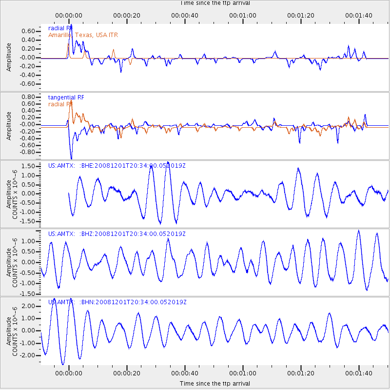
AMTX Amarillo, Texas, USA - Earthquake Result Viewer
*The percent match for this event was below the threshold and hence no stack was calculated.
| Earthquake location: |
Tonga Islands Region |
| Earthquake latitude/longitude: |
-22.9/-175.2 |
| Earthquake time(UTC): |
2008/12/01 (336) 20:21:34 GMT |
| Earthquake Depth: |
39 km |
| Earthquake Magnitude: |
5.5 MB, 5.1 MS |
| Earthquake Catalog/Contributor: |
WHDF/NEIC |
|
| Network: |
US United States National Seismic Network |
| Station: |
AMTX Amarillo, Texas, USA |
| Lat/Lon: |
34.53 N/101.41 W |
| Elevation: |
1010 m |
|
| Distance: |
90.4 deg |
| Az: |
52.444 deg |
| Baz: |
242.273 deg |
| Ray Param: |
$rayparam |
*The percent match for this event was below the threshold and hence was not used in the summary stack. |
|
| Radial Match: |
61.20414 % |
| Radial Bump: |
400 |
| Transverse Match: |
57.090828 % |
| Transverse Bump: |
400 |
| SOD ConfigId: |
2658 |
| Insert Time: |
2010-03-05 03:05:38.056 +0000 |
| GWidth: |
2.5 |
| Max Bumps: |
400 |
| Tol: |
0.001 |
|
Signal To Noise
| Channel | StoN | STA | LTA |
| US:AMTX: :BHZ:20081201T20:34:00.052019Z | 0.94341373 | 5.2102115E-7 | 5.522722E-7 |
| US:AMTX: :BHN:20081201T20:34:00.052019Z | 1.9156244 | 1.7173153E-6 | 8.964781E-7 |
| US:AMTX: :BHE:20081201T20:34:00.052019Z | 2.4204 | 1.1918199E-6 | 4.924062E-7 |
| Arrivals |
| Ps | |
| PpPs | |
| PsPs/PpSs | |


