You are here: Home > Network List > US - United States National Seismic Network Stations List
> Station AMTX Amarillo, Texas, USA > Earthquake Result Viewer
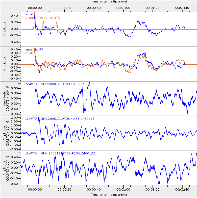
AMTX Amarillo, Texas, USA - Earthquake Result Viewer
*The percent match for this event was below the threshold and hence no stack was calculated.
| Earthquake location: |
Northern Mid-Atlantic Ridge |
| Earthquake latitude/longitude: |
47.0/-27.3 |
| Earthquake time(UTC): |
2008/12/19 (354) 08:31:51 GMT |
| Earthquake Depth: |
2.0 km |
| Earthquake Magnitude: |
5.8 MB, 5.6 MS, 5.9 MW, 5.8 MW |
| Earthquake Catalog/Contributor: |
WHDF/NEIC |
|
| Network: |
US United States National Seismic Network |
| Station: |
AMTX Amarillo, Texas, USA |
| Lat/Lon: |
34.53 N/101.41 W |
| Elevation: |
1010 m |
|
| Distance: |
55.5 deg |
| Az: |
285.585 deg |
| Baz: |
52.99 deg |
| Ray Param: |
$rayparam |
*The percent match for this event was below the threshold and hence was not used in the summary stack. |
|
| Radial Match: |
57.671085 % |
| Radial Bump: |
400 |
| Transverse Match: |
47.252396 % |
| Transverse Bump: |
400 |
| SOD ConfigId: |
2658 |
| Insert Time: |
2010-03-05 03:06:04.302 +0000 |
| GWidth: |
2.5 |
| Max Bumps: |
400 |
| Tol: |
0.001 |
|
Signal To Noise
| Channel | StoN | STA | LTA |
| US:AMTX: :BHZ:20081219T08:40:56.246013Z | 7.373954 | 9.262962E-7 | 1.256173E-7 |
| US:AMTX: :BHN:20081219T08:40:56.246013Z | 1.5432826 | 2.3129847E-7 | 1.4987435E-7 |
| US:AMTX: :BHE:20081219T08:40:56.246013Z | 1.9655715 | 4.744403E-7 | 2.4137523E-7 |
| Arrivals |
| Ps | |
| PpPs | |
| PsPs/PpSs | |


