You are here: Home > Network List > US - United States National Seismic Network Stations List
> Station AMTX Amarillo, Texas, USA > Earthquake Result Viewer
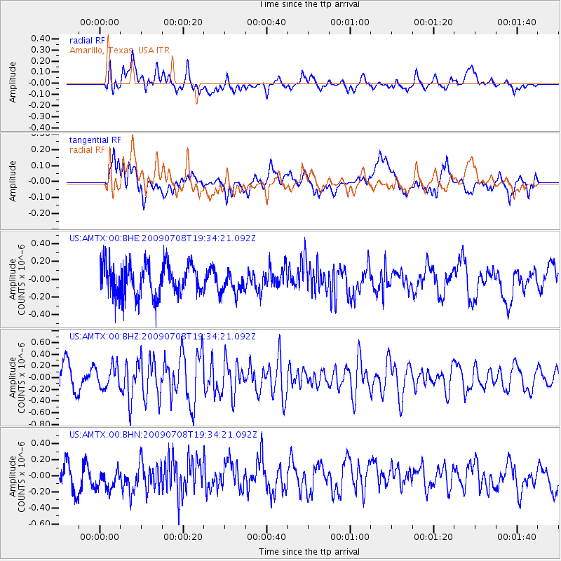
AMTX Amarillo, Texas, USA - Earthquake Result Viewer
*The percent match for this event was below the threshold and hence no stack was calculated.
| Earthquake location: |
Southeast Of Easter Island |
| Earthquake latitude/longitude: |
-36.0/-102.7 |
| Earthquake time(UTC): |
2009/07/08 (189) 19:23:37 GMT |
| Earthquake Depth: |
12 km |
| Earthquake Magnitude: |
5.5 MS, 5.4 MB, 6.0 MW, 5.9 MW |
| Earthquake Catalog/Contributor: |
WHDF/NEIC |
|
| Network: |
US United States National Seismic Network |
| Station: |
AMTX Amarillo, Texas, USA |
| Lat/Lon: |
34.53 N/101.41 W |
| Elevation: |
1010 m |
|
| Distance: |
70.2 deg |
| Az: |
1.121 deg |
| Baz: |
181.101 deg |
| Ray Param: |
$rayparam |
*The percent match for this event was below the threshold and hence was not used in the summary stack. |
|
| Radial Match: |
63.292877 % |
| Radial Bump: |
400 |
| Transverse Match: |
51.78816 % |
| Transverse Bump: |
400 |
| SOD ConfigId: |
2648 |
| Insert Time: |
2010-03-05 03:06:15.085 +0000 |
| GWidth: |
2.5 |
| Max Bumps: |
400 |
| Tol: |
0.001 |
|
Signal To Noise
| Channel | StoN | STA | LTA |
| US:AMTX:00:BHZ:20090708T19:34:21.092Z | 0.86487675 | 1.8612081E-7 | 2.1519924E-7 |
| US:AMTX:00:BHN:20090708T19:34:21.092Z | 0.66294956 | 1.2563055E-7 | 1.895024E-7 |
| US:AMTX:00:BHE:20090708T19:34:21.092Z | 0.6625792 | 1.2363681E-7 | 1.865993E-7 |
| Arrivals |
| Ps | |
| PpPs | |
| PsPs/PpSs | |


