You are here: Home > Network List > US - United States National Seismic Network Stations List
> Station AMTX Amarillo, Texas, USA > Earthquake Result Viewer
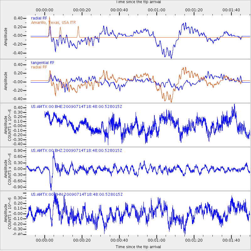
AMTX Amarillo, Texas, USA - Earthquake Result Viewer
*The percent match for this event was below the threshold and hence no stack was calculated.
| Earthquake location: |
Chile-Bolivia Border Region |
| Earthquake latitude/longitude: |
-21.8/-67.1 |
| Earthquake time(UTC): |
2009/07/14 (195) 18:38:08 GMT |
| Earthquake Depth: |
176 km |
| Earthquake Magnitude: |
5.7 MW, 5.4 MB, 5.7 MW |
| Earthquake Catalog/Contributor: |
WHDF/NEIC |
|
| Network: |
US United States National Seismic Network |
| Station: |
AMTX Amarillo, Texas, USA |
| Lat/Lon: |
34.53 N/101.41 W |
| Elevation: |
1010 m |
|
| Distance: |
64.8 deg |
| Az: |
329.051 deg |
| Baz: |
144.634 deg |
| Ray Param: |
$rayparam |
*The percent match for this event was below the threshold and hence was not used in the summary stack. |
|
| Radial Match: |
51.151325 % |
| Radial Bump: |
400 |
| Transverse Match: |
34.57315 % |
| Transverse Bump: |
400 |
| SOD ConfigId: |
2648 |
| Insert Time: |
2010-03-05 03:06:17.323 +0000 |
| GWidth: |
2.5 |
| Max Bumps: |
400 |
| Tol: |
0.001 |
|
Signal To Noise
| Channel | StoN | STA | LTA |
| US:AMTX:00:BHZ:20090714T18:48:00.528015Z | 5.272254 | 4.2096102E-7 | 7.98446E-8 |
| US:AMTX:00:BHN:20090714T18:48:00.528015Z | 1.9494255 | 1.2021411E-7 | 6.1666434E-8 |
| US:AMTX:00:BHE:20090714T18:48:00.528015Z | 1.8436005 | 2.0198003E-7 | 1.0955737E-7 |
| Arrivals |
| Ps | |
| PpPs | |
| PsPs/PpSs | |


