You are here: Home > Network List > US - United States National Seismic Network Stations List
> Station HAWA Hanford, Washington, USA > Earthquake Result Viewer
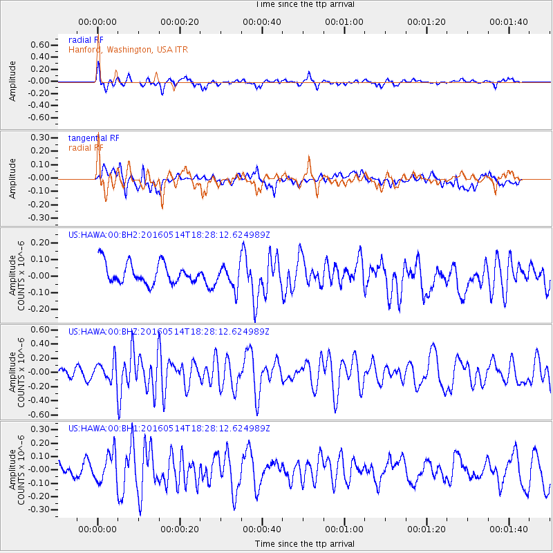
HAWA Hanford, Washington, USA - Earthquake Result Viewer
*The percent match for this event was below the threshold and hence no stack was calculated.
| Earthquake location: |
Northern East Pacific Rise |
| Earthquake latitude/longitude: |
8.5/-102.8 |
| Earthquake time(UTC): |
2016/05/14 (135) 18:21:05 GMT |
| Earthquake Depth: |
10 km |
| Earthquake Magnitude: |
5.8 MWW, 5.6 MWB, 5.7 MWC |
| Earthquake Catalog/Contributor: |
NEIC PDE/NEIC COMCAT |
|
| Network: |
US United States National Seismic Network |
| Station: |
HAWA Hanford, Washington, USA |
| Lat/Lon: |
46.39 N/119.53 W |
| Elevation: |
364 m |
|
| Distance: |
40.4 deg |
| Az: |
342.118 deg |
| Baz: |
153.974 deg |
| Ray Param: |
$rayparam |
*The percent match for this event was below the threshold and hence was not used in the summary stack. |
|
| Radial Match: |
59.29416 % |
| Radial Bump: |
400 |
| Transverse Match: |
58.353188 % |
| Transverse Bump: |
400 |
| SOD ConfigId: |
7422571 |
| Insert Time: |
2019-04-22 14:12:20.238 +0000 |
| GWidth: |
2.5 |
| Max Bumps: |
400 |
| Tol: |
0.001 |
|
Signal To Noise
| Channel | StoN | STA | LTA |
| US:HAWA:00:BHZ:20160514T18:28:12.624989Z | 2.0849018 | 1.5407326E-7 | 7.389953E-8 |
| US:HAWA:00:BH1:20160514T18:28:12.624989Z | 1.99017 | 1.1494032E-7 | 5.7754022E-8 |
| US:HAWA:00:BH2:20160514T18:28:12.624989Z | 1.1100587 | 6.899638E-8 | 6.2155614E-8 |
| Arrivals |
| Ps | |
| PpPs | |
| PsPs/PpSs | |


