You are here: Home > Network List > KN - Kyrgyz Seismic Telemetry Network Stations List
> Station CHM KN.CHM > Earthquake Result Viewer
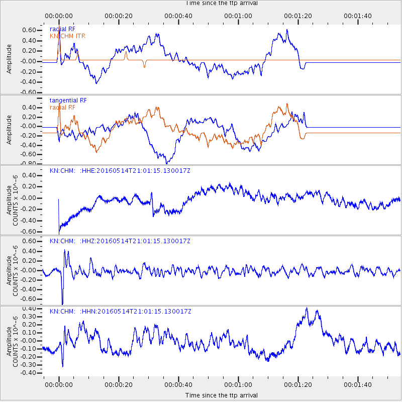
CHM KN.CHM - Earthquake Result Viewer
*The percent match for this event was below the threshold and hence no stack was calculated.
| Earthquake location: |
Southwest Of Sumatra, Indonesia |
| Earthquake latitude/longitude: |
-6.9/101.8 |
| Earthquake time(UTC): |
2016/05/14 (135) 20:52:11 GMT |
| Earthquake Depth: |
10 km |
| Earthquake Magnitude: |
5.6 MB, 5.3 MWW |
| Earthquake Catalog/Contributor: |
NEIC PDE/NEIC COMCAT |
|
| Network: |
KN Kyrgyz Seismic Telemetry Network |
| Station: |
CHM KN.CHM |
| Lat/Lon: |
43.00 N/74.75 E |
| Elevation: |
655 m |
|
| Distance: |
55.4 deg |
| Az: |
336.095 deg |
| Baz: |
146.741 deg |
| Ray Param: |
$rayparam |
*The percent match for this event was below the threshold and hence was not used in the summary stack. |
|
| Radial Match: |
25.77912 % |
| Radial Bump: |
400 |
| Transverse Match: |
22.680855 % |
| Transverse Bump: |
400 |
| SOD ConfigId: |
7422571 |
| Insert Time: |
2019-04-22 14:15:51.716 +0000 |
| GWidth: |
2.5 |
| Max Bumps: |
400 |
| Tol: |
0.001 |
|
Signal To Noise
| Channel | StoN | STA | LTA |
| KN:CHM: :HHZ:20160514T21:01:15.130017Z | 6.828038 | 2.523664E-7 | 3.6960312E-8 |
| KN:CHM: :HHN:20160514T21:01:15.130017Z | 0.9099885 | 1.2305543E-7 | 1.3522744E-7 |
| KN:CHM: :HHE:20160514T21:01:15.130017Z | 0.6104872 | 1.0112009E-7 | 1.6563833E-7 |
| Arrivals |
| Ps | |
| PpPs | |
| PsPs/PpSs | |


