You are here: Home > Network List > KN - Kyrgyz Seismic Telemetry Network Stations List
> Station ULHL - > Earthquake Result Viewer
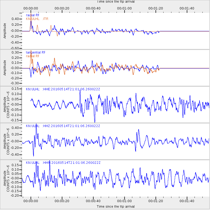
ULHL - - Earthquake Result Viewer
*The percent match for this event was below the threshold and hence no stack was calculated.
| Earthquake location: |
Southwest Of Sumatra, Indonesia |
| Earthquake latitude/longitude: |
-6.9/101.8 |
| Earthquake time(UTC): |
2016/05/14 (135) 20:52:11 GMT |
| Earthquake Depth: |
10 km |
| Earthquake Magnitude: |
5.6 MB, 5.3 MWW |
| Earthquake Catalog/Contributor: |
NEIC PDE/NEIC COMCAT |
|
| Network: |
KN Kyrgyz Seismic Telemetry Network |
| Station: |
ULHL - |
| Lat/Lon: |
42.25 N/76.24 E |
| Elevation: |
2040 m |
|
| Distance: |
54.2 deg |
| Az: |
336.734 deg |
| Baz: |
148.115 deg |
| Ray Param: |
$rayparam |
*The percent match for this event was below the threshold and hence was not used in the summary stack. |
|
| Radial Match: |
66.21063 % |
| Radial Bump: |
400 |
| Transverse Match: |
62.514847 % |
| Transverse Bump: |
400 |
| SOD ConfigId: |
7422571 |
| Insert Time: |
2019-04-22 14:15:57.866 +0000 |
| GWidth: |
2.5 |
| Max Bumps: |
400 |
| Tol: |
0.001 |
|
Signal To Noise
| Channel | StoN | STA | LTA |
| KN:ULHL: :HHZ:20160514T21:01:06.260022Z | 3.9831295 | 2.0333454E-7 | 5.104894E-8 |
| KN:ULHL: :HHN:20160514T21:01:06.260022Z | 2.754271 | 7.658705E-8 | 2.780665E-8 |
| KN:ULHL: :HHE:20160514T21:01:06.260022Z | 2.5370607 | 6.087237E-8 | 2.3993262E-8 |
| Arrivals |
| Ps | |
| PpPs | |
| PsPs/PpSs | |


