You are here: Home > Network List > AZ - ANZA Regional Network Stations List
> Station FRD AZ.FRD > Earthquake Result Viewer
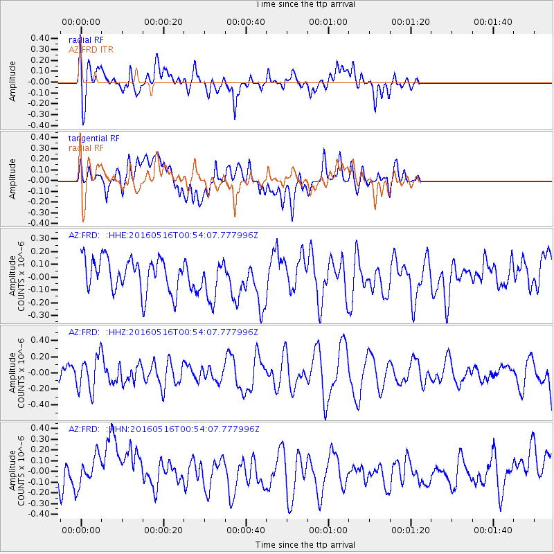
FRD AZ.FRD - Earthquake Result Viewer
*The percent match for this event was below the threshold and hence no stack was calculated.
| Earthquake location: |
Southeast Of Loyalty Islands |
| Earthquake latitude/longitude: |
-22.5/173.0 |
| Earthquake time(UTC): |
2016/05/16 (137) 00:41:53 GMT |
| Earthquake Depth: |
10 km |
| Earthquake Magnitude: |
5.8 MWW, 5.7 MWB, 5.8 MWC |
| Earthquake Catalog/Contributor: |
NEIC PDE/NEIC COMCAT |
|
| Network: |
AZ ANZA Regional Network |
| Station: |
FRD AZ.FRD |
| Lat/Lon: |
33.49 N/116.60 W |
| Elevation: |
1164 m |
|
| Distance: |
87.1 deg |
| Az: |
52.022 deg |
| Baz: |
240.719 deg |
| Ray Param: |
$rayparam |
*The percent match for this event was below the threshold and hence was not used in the summary stack. |
|
| Radial Match: |
51.45339 % |
| Radial Bump: |
400 |
| Transverse Match: |
39.18836 % |
| Transverse Bump: |
400 |
| SOD ConfigId: |
7422571 |
| Insert Time: |
2019-04-22 14:19:54.227 +0000 |
| GWidth: |
2.5 |
| Max Bumps: |
400 |
| Tol: |
0.001 |
|
Signal To Noise
| Channel | StoN | STA | LTA |
| AZ:FRD: :HHZ:20160516T00:54:07.777996Z | 1.6190835 | 2.1683269E-7 | 1.339231E-7 |
| AZ:FRD: :HHN:20160516T00:54:07.777996Z | 1.0849948 | 1.703958E-7 | 1.5704757E-7 |
| AZ:FRD: :HHE:20160516T00:54:07.777996Z | 1.2183607 | 1.5824097E-7 | 1.2988023E-7 |
| Arrivals |
| Ps | |
| PpPs | |
| PsPs/PpSs | |


