You are here: Home > Network List > CI - Caltech Regional Seismic Network Stations List
> Station IRM Iron Mountain Pumping Station, Eagle Mtn., CA, USA > Earthquake Result Viewer
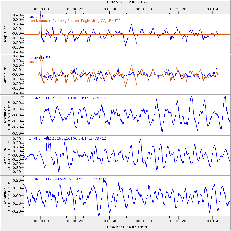
IRM Iron Mountain Pumping Station, Eagle Mtn., CA, USA - Earthquake Result Viewer
*The percent match for this event was below the threshold and hence no stack was calculated.
| Earthquake location: |
Southeast Of Loyalty Islands |
| Earthquake latitude/longitude: |
-22.5/173.0 |
| Earthquake time(UTC): |
2016/05/16 (137) 00:41:53 GMT |
| Earthquake Depth: |
10 km |
| Earthquake Magnitude: |
5.8 MWW, 5.7 MWB, 5.8 MWC |
| Earthquake Catalog/Contributor: |
NEIC PDE/NEIC COMCAT |
|
| Network: |
CI Caltech Regional Seismic Network |
| Station: |
IRM Iron Mountain Pumping Station, Eagle Mtn., CA, USA |
| Lat/Lon: |
34.16 N/115.15 W |
| Elevation: |
567 m |
|
| Distance: |
88.5 deg |
| Az: |
52.029 deg |
| Baz: |
241.527 deg |
| Ray Param: |
$rayparam |
*The percent match for this event was below the threshold and hence was not used in the summary stack. |
|
| Radial Match: |
64.4341 % |
| Radial Bump: |
381 |
| Transverse Match: |
54.47206 % |
| Transverse Bump: |
381 |
| SOD ConfigId: |
7422571 |
| Insert Time: |
2019-04-22 14:20:34.697 +0000 |
| GWidth: |
2.5 |
| Max Bumps: |
400 |
| Tol: |
0.001 |
|
Signal To Noise
| Channel | StoN | STA | LTA |
| CI:IRM: :HHZ:20160516T00:54:14.377971Z | 3.0175564 | 2.1539023E-7 | 7.137902E-8 |
| CI:IRM: :HHN:20160516T00:54:14.377971Z | 0.80475605 | 6.7230374E-8 | 8.354131E-8 |
| CI:IRM: :HHE:20160516T00:54:14.377971Z | 0.4101117 | 3.4422236E-8 | 8.3933806E-8 |
| Arrivals |
| Ps | |
| PpPs | |
| PsPs/PpSs | |


