You are here: Home > Network List > TA - USArray Transportable Network (new EarthScope stations) Stations List
> Station J26L Joseph Creek, AK, USA > Earthquake Result Viewer
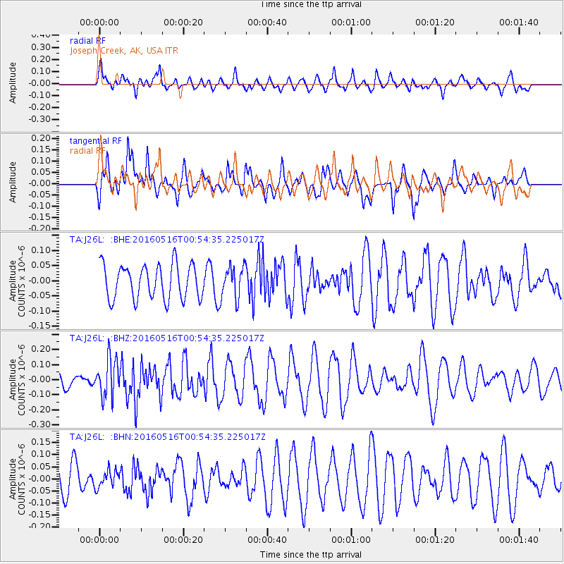
J26L Joseph Creek, AK, USA - Earthquake Result Viewer
*The percent match for this event was below the threshold and hence no stack was calculated.
| Earthquake location: |
Southeast Of Loyalty Islands |
| Earthquake latitude/longitude: |
-22.5/173.0 |
| Earthquake time(UTC): |
2016/05/16 (137) 00:41:53 GMT |
| Earthquake Depth: |
10 km |
| Earthquake Magnitude: |
5.8 MWW, 5.7 MWB, 5.8 MWC |
| Earthquake Catalog/Contributor: |
NEIC PDE/NEIC COMCAT |
|
| Network: |
TA USArray Transportable Network (new EarthScope stations) |
| Station: |
J26L Joseph Creek, AK, USA |
| Lat/Lon: |
64.50 N/143.56 W |
| Elevation: |
1144 m |
|
| Distance: |
93.0 deg |
| Az: |
17.343 deg |
| Baz: |
219.552 deg |
| Ray Param: |
$rayparam |
*The percent match for this event was below the threshold and hence was not used in the summary stack. |
|
| Radial Match: |
39.293392 % |
| Radial Bump: |
400 |
| Transverse Match: |
51.3404 % |
| Transverse Bump: |
400 |
| SOD ConfigId: |
7422571 |
| Insert Time: |
2019-04-22 14:22:41.855 +0000 |
| GWidth: |
2.5 |
| Max Bumps: |
400 |
| Tol: |
0.001 |
|
Signal To Noise
| Channel | StoN | STA | LTA |
| TA:J26L: :BHZ:20160516T00:54:35.225017Z | 2.533057 | 1.2976751E-7 | 5.122961E-8 |
| TA:J26L: :BHN:20160516T00:54:35.225017Z | 0.6064949 | 3.4847808E-8 | 5.745771E-8 |
| TA:J26L: :BHE:20160516T00:54:35.225017Z | 0.9105572 | 5.1656077E-8 | 5.6730183E-8 |
| Arrivals |
| Ps | |
| PpPs | |
| PsPs/PpSs | |


