You are here: Home > Network List > TA - USArray Transportable Network (new EarthScope stations) Stations List
> Station N23A Red Feather Lakes, CO, USA > Earthquake Result Viewer
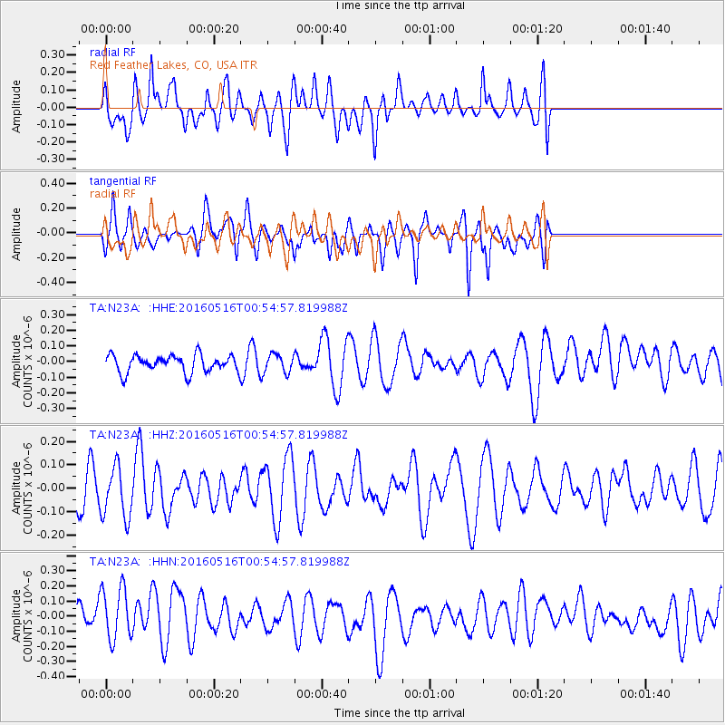
N23A Red Feather Lakes, CO, USA - Earthquake Result Viewer
*The percent match for this event was below the threshold and hence no stack was calculated.
| Earthquake location: |
Southeast Of Loyalty Islands |
| Earthquake latitude/longitude: |
-22.5/173.0 |
| Earthquake time(UTC): |
2016/05/16 (137) 00:41:53 GMT |
| Earthquake Depth: |
10 km |
| Earthquake Magnitude: |
5.8 MWW, 5.7 MWB, 5.8 MWC |
| Earthquake Catalog/Contributor: |
NEIC PDE/NEIC COMCAT |
|
| Network: |
TA USArray Transportable Network (new EarthScope stations) |
| Station: |
N23A Red Feather Lakes, CO, USA |
| Lat/Lon: |
40.89 N/105.94 W |
| Elevation: |
2458 m |
|
| Distance: |
98.0 deg |
| Az: |
49.138 deg |
| Baz: |
247.291 deg |
| Ray Param: |
$rayparam |
*The percent match for this event was below the threshold and hence was not used in the summary stack. |
|
| Radial Match: |
34.444088 % |
| Radial Bump: |
400 |
| Transverse Match: |
40.533924 % |
| Transverse Bump: |
400 |
| SOD ConfigId: |
7422571 |
| Insert Time: |
2019-04-22 14:22:48.602 +0000 |
| GWidth: |
2.5 |
| Max Bumps: |
400 |
| Tol: |
0.001 |
|
Signal To Noise
| Channel | StoN | STA | LTA |
| TA:N23A: :HHZ:20160516T00:54:57.819988Z | 1.4985117 | 1.1176471E-7 | 7.458381E-8 |
| TA:N23A: :HHN:20160516T00:54:57.819988Z | 1.7452413 | 1.8004062E-7 | 1.0316087E-7 |
| TA:N23A: :HHE:20160516T00:54:57.819988Z | 1.096134 | 6.0342934E-8 | 5.5050695E-8 |
| Arrivals |
| Ps | |
| PpPs | |
| PsPs/PpSs | |


