ACSO Alum Creek State Park, Ohio, USA - Earthquake Result Viewer
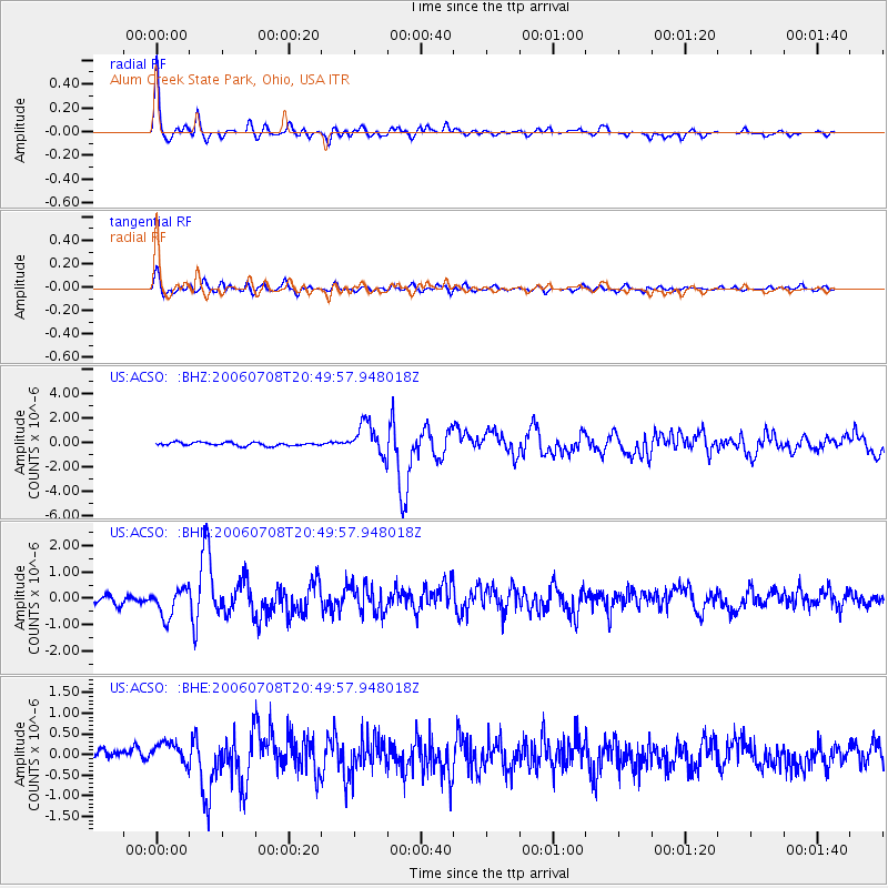
Earthquake location: Andreanof Islands, Aleutian Is.
Earthquake latitude/longitude: 51.2/-179.3
Earthquake time(UTC): 2006/07/08 (189) 20:40:00 GMT
Earthquake Depth: 22 km
Earthquake Magnitude: 6.2 MB, 6.4 MS, 6.6 MW, 6.6 MW
Earthquake Catalog/Contributor: WHDF/NEIC
Network: US United States National Seismic Network
Station: ACSO Alum Creek State Park, Ohio, USA
Lat/Lon: 40.23 N/82.98 W
Elevation: 288 m
Distance: 63.4 deg
Az: 58.282 deg
Baz: 315.664 deg
Ray Param: 0.059546657
Estimated Moho Depth: 49.0 km
Estimated Crust Vp/Vs: 1.78
Assumed Crust Vp: 6.498 km/s
Estimated Crust Vs: 3.65 km/s
Estimated Crust Poisson's Ratio: 0.27
Radial Match: 94.229004 %
Radial Bump: 357
Transverse Match: 83.348885 %
Transverse Bump: 400
SOD ConfigId: 5423
Insert Time: 2010-03-05 03:10:01.329 +0000
GWidth: 2.5
Max Bumps: 400
Tol: 0.001

Signal To Noise

ChannelStoNSTALTA
US:ACSO: :BHN:20060708T20:49:57.948018Z3.64807275.3057494E-71.454398E-7
US:ACSO: :BHE:20060708T20:49:57.948018Z2.49189232.5206023E-71.0115213E-7
US:ACSO: :BHZ:20060708T20:49:57.948018Z9.5028611.3176452E-61.3865774E-7
Arrivals
Ps6.1 SECOND
PpPs20 SECOND
PsPs/PpSs26 SECOND