You are here: Home > Network List > WY - Yellowstone Wyoming Seismic Network Stations List
> Station YHR Hawk's Rest, WY, USA > Earthquake Result Viewer
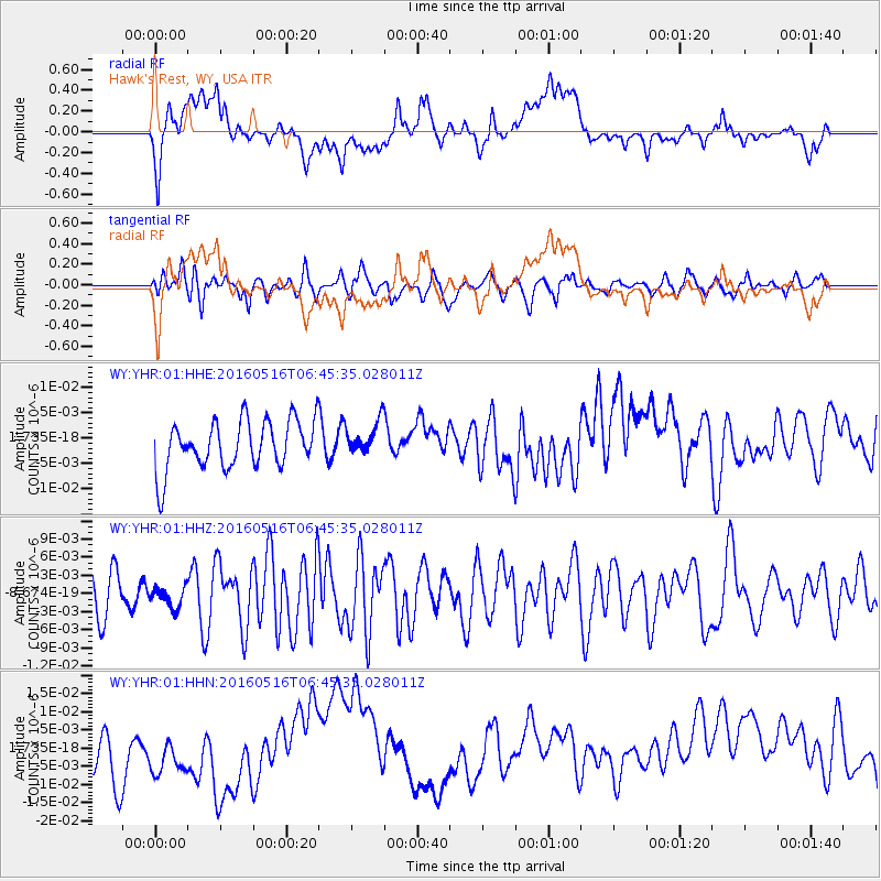
YHR Hawk's Rest, WY, USA - Earthquake Result Viewer
*The percent match for this event was below the threshold and hence no stack was calculated.
| Earthquake location: |
Northern East Pacific Rise |
| Earthquake latitude/longitude: |
8.5/-103.1 |
| Earthquake time(UTC): |
2016/05/16 (137) 06:39:04 GMT |
| Earthquake Depth: |
10 km |
| Earthquake Magnitude: |
5.5 mwc |
| Earthquake Catalog/Contributor: |
NEIC PDE/us |
|
| Network: |
WY Yellowstone Wyoming Seismic Network |
| Station: |
YHR Hawk's Rest, WY, USA |
| Lat/Lon: |
44.11 N/110.08 W |
| Elevation: |
2976 m |
|
| Distance: |
36.0 deg |
| Az: |
351.444 deg |
| Baz: |
168.212 deg |
| Ray Param: |
$rayparam |
*The percent match for this event was below the threshold and hence was not used in the summary stack. |
|
| Radial Match: |
22.106764 % |
| Radial Bump: |
400 |
| Transverse Match: |
61.27834 % |
| Transverse Bump: |
400 |
| SOD ConfigId: |
7422571 |
| Insert Time: |
2019-04-22 14:31:36.289 +0000 |
| GWidth: |
2.5 |
| Max Bumps: |
400 |
| Tol: |
0.001 |
|
Signal To Noise
| Channel | StoN | STA | LTA |
| WY:YHR:01:HHZ:20160516T06:45:35.028011Z | 0.6291795 | 1.7676528E-9 | 2.8094571E-9 |
| WY:YHR:01:HHN:20160516T06:45:35.028011Z | 0.94386965 | 8.389331E-9 | 8.888231E-9 |
| WY:YHR:01:HHE:20160516T06:45:35.028011Z | 0.7037747 | 3.3820609E-9 | 4.8056017E-9 |
| Arrivals |
| Ps | |
| PpPs | |
| PsPs/PpSs | |


