You are here: Home > Network List > GS - US Geological Survey Networks Stations List
> Station KAN11 Stewart Ranch, Harper County, KS, USA > Earthquake Result Viewer
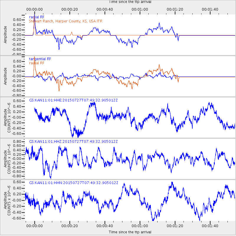
KAN11 Stewart Ranch, Harper County, KS, USA - Earthquake Result Viewer
*The percent match for this event was below the threshold and hence no stack was calculated.
| Earthquake location: |
Fox Islands, Aleutian Islands |
| Earthquake latitude/longitude: |
52.5/-169.7 |
| Earthquake time(UTC): |
2015/07/27 (208) 07:41:02 GMT |
| Earthquake Depth: |
16 km |
| Earthquake Magnitude: |
5.6 MB |
| Earthquake Catalog/Contributor: |
NEIC PDE/NEIC COMCAT |
|
| Network: |
GS US Geological Survey Networks |
| Station: |
KAN11 Stewart Ranch, Harper County, KS, USA |
| Lat/Lon: |
37.21 N/97.91 W |
| Elevation: |
410 m |
|
| Distance: |
51.0 deg |
| Az: |
77.267 deg |
| Baz: |
311.619 deg |
| Ray Param: |
$rayparam |
*The percent match for this event was below the threshold and hence was not used in the summary stack. |
|
| Radial Match: |
66.168274 % |
| Radial Bump: |
400 |
| Transverse Match: |
65.40223 % |
| Transverse Bump: |
400 |
| SOD ConfigId: |
1085051 |
| Insert Time: |
2015-09-03 14:31:05.220 +0000 |
| GWidth: |
2.5 |
| Max Bumps: |
400 |
| Tol: |
0.001 |
|
Signal To Noise
| Channel | StoN | STA | LTA |
| GS:KAN11:01:HHZ:20150727T07:49:32.905012Z | 0.98206604 | 3.649248E-7 | 3.7158887E-7 |
| GS:KAN11:01:HHN:20150727T07:49:32.905012Z | 1.0932356 | 2.6165705E-7 | 2.3934186E-7 |
| GS:KAN11:01:HHE:20150727T07:49:32.905012Z | 1.4212285 | 4.0454637E-7 | 2.8464552E-7 |
| Arrivals |
| Ps | |
| PpPs | |
| PsPs/PpSs | |


