You are here: Home > Network List > US - United States National Seismic Network Stations List
> Station SDCO Great Sand Dunes National Park, Colorado, USA > Earthquake Result Viewer
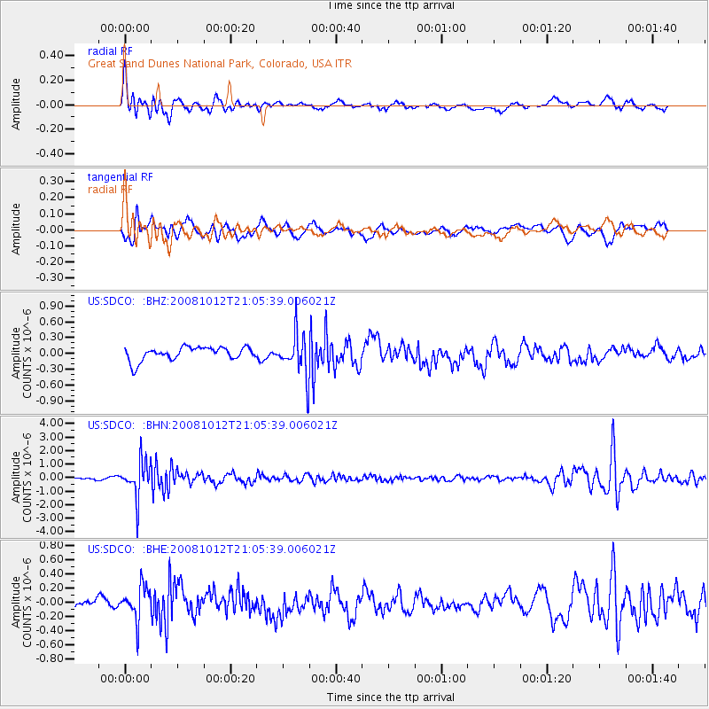
SDCO Great Sand Dunes National Park, Colorado, USA - Earthquake Result Viewer
*The percent match for this event was below the threshold and hence no stack was calculated.
| Earthquake location: |
Southern Bolivia |
| Earthquake latitude/longitude: |
-20.1/-65.0 |
| Earthquake time(UTC): |
2008/10/12 (286) 20:55:41 GMT |
| Earthquake Depth: |
353 km |
| Earthquake Magnitude: |
6.0 MB, 6.2 MW, 6.2 MW |
| Earthquake Catalog/Contributor: |
WHDF/NEIC |
|
| Network: |
US United States National Seismic Network |
| Station: |
SDCO Great Sand Dunes National Park, Colorado, USA |
| Lat/Lon: |
37.75 N/105.50 W |
| Elevation: |
2569 m |
|
| Distance: |
69.0 deg |
| Az: |
326.52 deg |
| Baz: |
139.161 deg |
| Ray Param: |
$rayparam |
*The percent match for this event was below the threshold and hence was not used in the summary stack. |
|
| Radial Match: |
75.792175 % |
| Radial Bump: |
400 |
| Transverse Match: |
58.119022 % |
| Transverse Bump: |
400 |
| SOD ConfigId: |
2560 |
| Insert Time: |
2010-03-05 03:16:36.537 +0000 |
| GWidth: |
2.5 |
| Max Bumps: |
400 |
| Tol: |
0.001 |
|
Signal To Noise
| Channel | StoN | STA | LTA |
| US:SDCO: :BHN:20081012T21:05:39.006021Z | 15.246317 | 1.3480463E-6 | 8.8417835E-8 |
| US:SDCO: :BHE:20081012T21:05:39.006021Z | 2.6274557 | 2.4409485E-7 | 9.2901594E-8 |
| US:SDCO: :BHZ:20081012T21:05:39.006021Z | 3.2485805 | 4.1265537E-7 | 1.2702637E-7 |
| Arrivals |
| Ps | |
| PpPs | |
| PsPs/PpSs | |


