You are here: Home > Network List > US - United States National Seismic Network Stations List
> Station CBKS Cedar Bluff, Kansas, USA > Earthquake Result Viewer
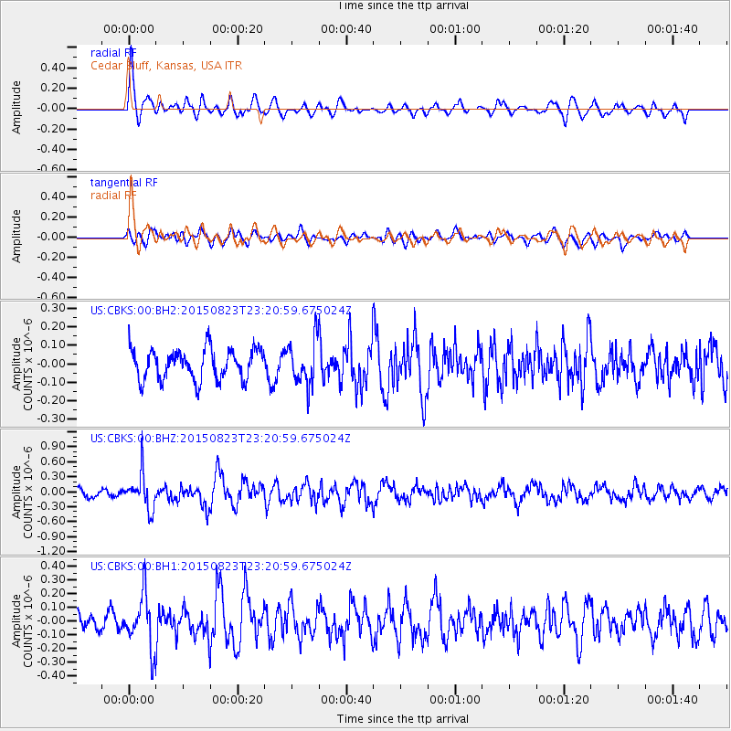
CBKS Cedar Bluff, Kansas, USA - Earthquake Result Viewer
*The percent match for this event was below the threshold and hence no stack was calculated.
| Earthquake location: |
Near Coast Of Central Chile |
| Earthquake latitude/longitude: |
-29.7/-71.4 |
| Earthquake time(UTC): |
2015/08/23 (235) 23:10:03 GMT |
| Earthquake Depth: |
34 km |
| Earthquake Magnitude: |
5.5 MB, 5.5 MB |
| Earthquake Catalog/Contributor: |
NEIC PDE/NEIC ALERT |
|
| Network: |
US United States National Seismic Network |
| Station: |
CBKS Cedar Bluff, Kansas, USA |
| Lat/Lon: |
38.81 N/99.74 W |
| Elevation: |
677 m |
|
| Distance: |
73.1 deg |
| Az: |
337.214 deg |
| Baz: |
154.441 deg |
| Ray Param: |
$rayparam |
*The percent match for this event was below the threshold and hence was not used in the summary stack. |
|
| Radial Match: |
67.6357 % |
| Radial Bump: |
400 |
| Transverse Match: |
50.35317 % |
| Transverse Bump: |
400 |
| SOD ConfigId: |
1085051 |
| Insert Time: |
2015-09-06 23:23:27.511 +0000 |
| GWidth: |
2.5 |
| Max Bumps: |
400 |
| Tol: |
0.001 |
|
Signal To Noise
| Channel | StoN | STA | LTA |
| US:CBKS:00:BHZ:20150823T23:20:59.675024Z | 4.7694497 | 3.5900774E-7 | 7.527236E-8 |
| US:CBKS:00:BH1:20150823T23:20:59.675024Z | 2.9005542 | 1.9350468E-7 | 6.671301E-8 |
| US:CBKS:00:BH2:20150823T23:20:59.675024Z | 1.4694121 | 1.2055736E-7 | 8.204462E-8 |
| Arrivals |
| Ps | |
| PpPs | |
| PsPs/PpSs | |


