You are here: Home > Network List > GS - US Geological Survey Networks Stations List
> Station KAN10 Keim Farm > Earthquake Result Viewer
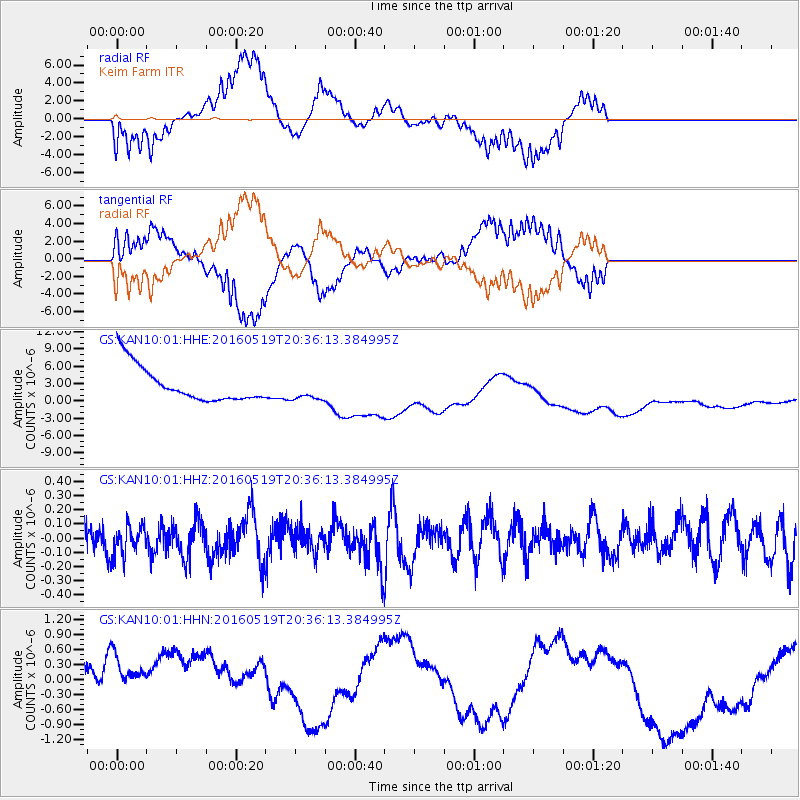
KAN10 Keim Farm - Earthquake Result Viewer
*The percent match for this event was below the threshold and hence no stack was calculated.
| Earthquake location: |
Catamarca Province, Argentina |
| Earthquake latitude/longitude: |
-28.0/-66.5 |
| Earthquake time(UTC): |
2016/05/19 (140) 20:25:42 GMT |
| Earthquake Depth: |
157 km |
| Earthquake Magnitude: |
5.1 Mww |
| Earthquake Catalog/Contributor: |
NEIC PDE/us |
|
| Network: |
GS US Geological Survey Networks |
| Station: |
KAN10 Keim Farm |
| Lat/Lon: |
37.12 N/98.10 W |
| Elevation: |
417 m |
|
| Distance: |
71.3 deg |
| Az: |
333.729 deg |
| Baz: |
150.676 deg |
| Ray Param: |
$rayparam |
*The percent match for this event was below the threshold and hence was not used in the summary stack. |
|
| Radial Match: |
70.88192 % |
| Radial Bump: |
400 |
| Transverse Match: |
71.67858 % |
| Transverse Bump: |
398 |
| SOD ConfigId: |
7422571 |
| Insert Time: |
2019-04-22 15:09:01.352 +0000 |
| GWidth: |
2.5 |
| Max Bumps: |
400 |
| Tol: |
0.001 |
|
Signal To Noise
| Channel | StoN | STA | LTA |
| GS:KAN10:01:HHZ:20160519T20:36:13.384995Z | 0.943464 | 1.1262717E-7 | 1.1937622E-7 |
| GS:KAN10:01:HHN:20160519T20:36:13.384995Z | 1.1709667 | 1.0768109E-6 | 9.1959134E-7 |
| GS:KAN10:01:HHE:20160519T20:36:13.384995Z | 0.65846646 | 2.0075936E-6 | 3.0488927E-6 |
| Arrivals |
| Ps | |
| PpPs | |
| PsPs/PpSs | |


