You are here: Home > Network List > US - United States National Seismic Network Stations List
> Station HAWA Hanford, Washington, USA > Earthquake Result Viewer
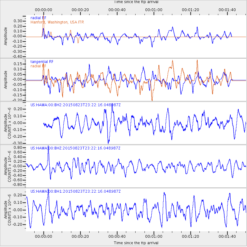
HAWA Hanford, Washington, USA - Earthquake Result Viewer
*The percent match for this event was below the threshold and hence no stack was calculated.
| Earthquake location: |
Near Coast Of Central Chile |
| Earthquake latitude/longitude: |
-29.7/-71.4 |
| Earthquake time(UTC): |
2015/08/23 (235) 23:10:03 GMT |
| Earthquake Depth: |
34 km |
| Earthquake Magnitude: |
5.5 MB, 5.5 MB |
| Earthquake Catalog/Contributor: |
NEIC PDE/NEIC ALERT |
|
| Network: |
US United States National Seismic Network |
| Station: |
HAWA Hanford, Washington, USA |
| Lat/Lon: |
46.39 N/119.53 W |
| Elevation: |
364 m |
|
| Distance: |
87.3 deg |
| Az: |
328.95 deg |
| Baz: |
139.567 deg |
| Ray Param: |
$rayparam |
*The percent match for this event was below the threshold and hence was not used in the summary stack. |
|
| Radial Match: |
64.4411 % |
| Radial Bump: |
400 |
| Transverse Match: |
48.652157 % |
| Transverse Bump: |
400 |
| SOD ConfigId: |
1085051 |
| Insert Time: |
2015-09-06 23:24:04.154 +0000 |
| GWidth: |
2.5 |
| Max Bumps: |
400 |
| Tol: |
0.001 |
|
Signal To Noise
| Channel | StoN | STA | LTA |
| US:HAWA:00:BHZ:20150823T23:22:16.048987Z | 2.942661 | 3.0926591E-7 | 1.05097364E-7 |
| US:HAWA:00:BH1:20150823T23:22:16.048987Z | 1.4350904 | 1.3882881E-7 | 9.673872E-8 |
| US:HAWA:00:BH2:20150823T23:22:16.048987Z | 1.2856331 | 1.0559628E-7 | 8.213563E-8 |
| Arrivals |
| Ps | |
| PpPs | |
| PsPs/PpSs | |


