You are here: Home > Network List > AZ - ANZA Regional Network Stations List
> Station PFO AZ.PFO > Earthquake Result Viewer
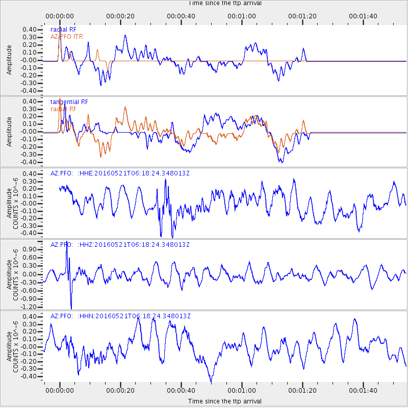
PFO AZ.PFO - Earthquake Result Viewer
*The percent match for this event was below the threshold and hence no stack was calculated.
| Earthquake location: |
Southeast Of Honshu, Japan |
| Earthquake latitude/longitude: |
30.9/140.1 |
| Earthquake time(UTC): |
2016/05/21 (142) 06:06:42 GMT |
| Earthquake Depth: |
130 km |
| Earthquake Magnitude: |
5.5 MB |
| Earthquake Catalog/Contributor: |
NEIC PDE/NEIC COMCAT |
|
| Network: |
AZ ANZA Regional Network |
| Station: |
PFO AZ.PFO |
| Lat/Lon: |
33.61 N/116.46 W |
| Elevation: |
1259 m |
|
| Distance: |
83.4 deg |
| Az: |
54.778 deg |
| Baz: |
302.737 deg |
| Ray Param: |
$rayparam |
*The percent match for this event was below the threshold and hence was not used in the summary stack. |
|
| Radial Match: |
52.73102 % |
| Radial Bump: |
400 |
| Transverse Match: |
52.053352 % |
| Transverse Bump: |
400 |
| SOD ConfigId: |
7422571 |
| Insert Time: |
2019-04-22 15:21:01.455 +0000 |
| GWidth: |
2.5 |
| Max Bumps: |
400 |
| Tol: |
0.001 |
|
Signal To Noise
| Channel | StoN | STA | LTA |
| AZ:PFO: :HHZ:20160521T06:18:24.348013Z | 2.238054 | 4.338176E-7 | 1.9383697E-7 |
| AZ:PFO: :HHN:20160521T06:18:24.348013Z | 0.765775 | 1.00949045E-7 | 1.3182598E-7 |
| AZ:PFO: :HHE:20160521T06:18:24.348013Z | 1.4915097 | 1.9495462E-7 | 1.307096E-7 |
| Arrivals |
| Ps | |
| PpPs | |
| PsPs/PpSs | |


