You are here: Home > Network List > CN - Canadian National Seismograph Network Stations List
> Station INK INUVIK, NT > Earthquake Result Viewer
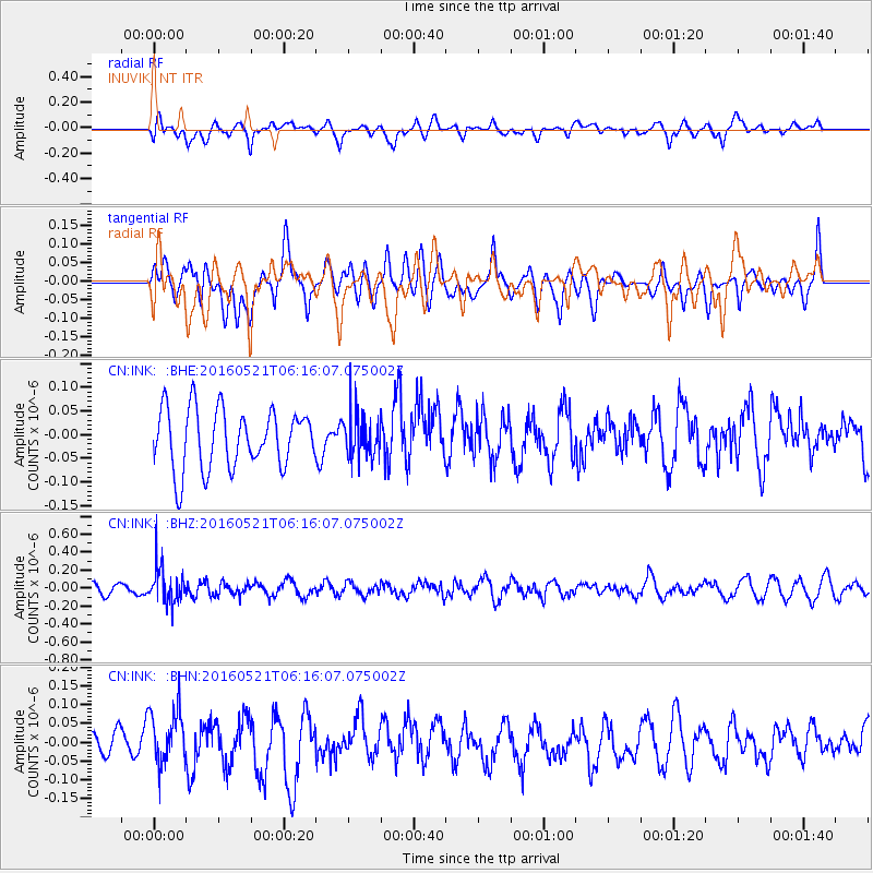
INK INUVIK, NT - Earthquake Result Viewer
*The percent match for this event was below the threshold and hence no stack was calculated.
| Earthquake location: |
Southeast Of Honshu, Japan |
| Earthquake latitude/longitude: |
30.9/140.1 |
| Earthquake time(UTC): |
2016/05/21 (142) 06:06:42 GMT |
| Earthquake Depth: |
130 km |
| Earthquake Magnitude: |
5.5 MB |
| Earthquake Catalog/Contributor: |
NEIC PDE/NEIC COMCAT |
|
| Network: |
CN Canadian National Seismograph Network |
| Station: |
INK INUVIK, NT |
| Lat/Lon: |
68.31 N/133.53 W |
| Elevation: |
44 m |
|
| Distance: |
60.3 deg |
| Az: |
25.277 deg |
| Baz: |
279.289 deg |
| Ray Param: |
$rayparam |
*The percent match for this event was below the threshold and hence was not used in the summary stack. |
|
| Radial Match: |
55.317493 % |
| Radial Bump: |
400 |
| Transverse Match: |
53.57044 % |
| Transverse Bump: |
400 |
| SOD ConfigId: |
7422571 |
| Insert Time: |
2019-04-22 15:21:59.920 +0000 |
| GWidth: |
2.5 |
| Max Bumps: |
400 |
| Tol: |
0.001 |
|
Signal To Noise
| Channel | StoN | STA | LTA |
| CN:INK: :BHZ:20160521T06:16:07.075002Z | 2.9119031 | 2.0260799E-7 | 6.957924E-8 |
| CN:INK: :BHN:20160521T06:16:07.075002Z | 1.91001 | 7.340709E-8 | 3.843283E-8 |
| CN:INK: :BHE:20160521T06:16:07.075002Z | 0.74132365 | 4.6505765E-8 | 6.273342E-8 |
| Arrivals |
| Ps | |
| PpPs | |
| PsPs/PpSs | |


