You are here: Home > Network List > IC - New China Digital Seismograph Network Stations List
> Station WMQ Urumqi, Xinjiang Province, China > Earthquake Result Viewer
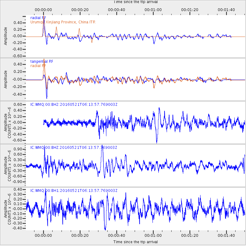
WMQ Urumqi, Xinjiang Province, China - Earthquake Result Viewer
*The percent match for this event was below the threshold and hence no stack was calculated.
| Earthquake location: |
Southeast Of Honshu, Japan |
| Earthquake latitude/longitude: |
30.9/140.1 |
| Earthquake time(UTC): |
2016/05/21 (142) 06:06:42 GMT |
| Earthquake Depth: |
130 km |
| Earthquake Magnitude: |
5.5 MB |
| Earthquake Catalog/Contributor: |
NEIC PDE/NEIC COMCAT |
|
| Network: |
IC New China Digital Seismograph Network |
| Station: |
WMQ Urumqi, Xinjiang Province, China |
| Lat/Lon: |
43.81 N/87.70 E |
| Elevation: |
850 m |
|
| Distance: |
42.9 deg |
| Az: |
302.605 deg |
| Baz: |
89.307 deg |
| Ray Param: |
$rayparam |
*The percent match for this event was below the threshold and hence was not used in the summary stack. |
|
| Radial Match: |
78.28781 % |
| Radial Bump: |
400 |
| Transverse Match: |
79.91835 % |
| Transverse Bump: |
400 |
| SOD ConfigId: |
7422571 |
| Insert Time: |
2019-04-22 15:23:04.174 +0000 |
| GWidth: |
2.5 |
| Max Bumps: |
400 |
| Tol: |
0.001 |
|
Signal To Noise
| Channel | StoN | STA | LTA |
| IC:WMQ:00:BHZ:20160521T06:13:57.769003Z | 4.4523025 | 3.6802479E-7 | 8.2659426E-8 |
| IC:WMQ:00:BH1:20160521T06:13:57.769003Z | 2.2545779 | 1.6070389E-7 | 7.127893E-8 |
| IC:WMQ:00:BH2:20160521T06:13:57.769003Z | 3.810997 | 2.0935076E-7 | 5.493333E-8 |
| Arrivals |
| Ps | |
| PpPs | |
| PsPs/PpSs | |


