You are here: Home > Network List > KN - Kyrgyz Seismic Telemetry Network Stations List
> Station ULHL - > Earthquake Result Viewer
ULHL - - Earthquake Result Viewer
*The percent match for this event was below the threshold and hence no stack was calculated.
| Earthquake location: |
Southeast Of Honshu, Japan |
| Earthquake latitude/longitude: |
30.9/140.1 |
| Earthquake time(UTC): |
2016/05/21 (142) 06:06:42 GMT |
| Earthquake Depth: |
130 km |
| Earthquake Magnitude: |
5.5 MB |
| Earthquake Catalog/Contributor: |
NEIC PDE/NEIC COMCAT |
|
| Network: |
KN Kyrgyz Seismic Telemetry Network |
| Station: |
ULHL - |
| Lat/Lon: |
42.25 N/76.24 E |
| Elevation: |
2040 m |
|
| Distance: |
51.4 deg |
| Az: |
301.48 deg |
| Baz: |
80.73 deg |
| Ray Param: |
$rayparam |
*The percent match for this event was below the threshold and hence was not used in the summary stack. |
|
| Radial Match: |
63.63973 % |
| Radial Bump: |
400 |
| Transverse Match: |
54.198933 % |
| Transverse Bump: |
400 |
| SOD ConfigId: |
7422571 |
| Insert Time: |
2019-04-22 15:23:29.744 +0000 |
| GWidth: |
2.5 |
| Max Bumps: |
400 |
| Tol: |
0.001 |
|
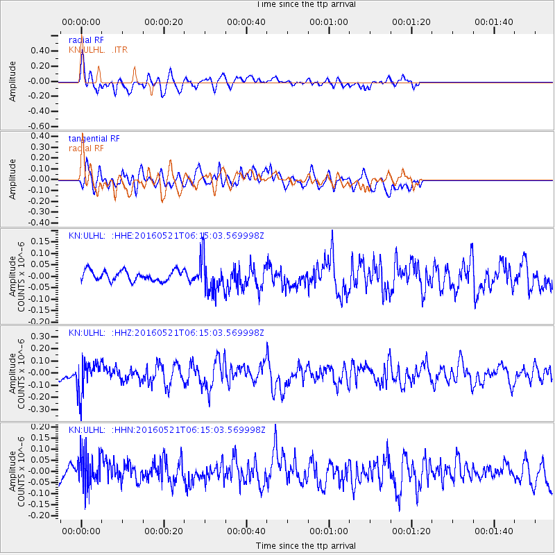
Signal To Noise
| Channel | StoN | STA | LTA |
| KN:ULHL: :HHZ:20160521T06:15:03.569998Z | 3.3927505 | 1.3067199E-7 | 3.851506E-8 |
| KN:ULHL: :HHN:20160521T06:15:03.569998Z | 2.9064372 | 8.29958E-8 | 2.8555855E-8 |
| KN:ULHL: :HHE:20160521T06:15:03.569998Z | 3.5190458 | 7.789576E-8 | 2.213548E-8 |
| Arrivals |
| Ps | |
| PpPs | |
| PsPs/PpSs | |


