You are here: Home > Network List > TA - USArray Transportable Network (new EarthScope stations) Stations List
> Station H04D Lebanon, OR, USA > Earthquake Result Viewer
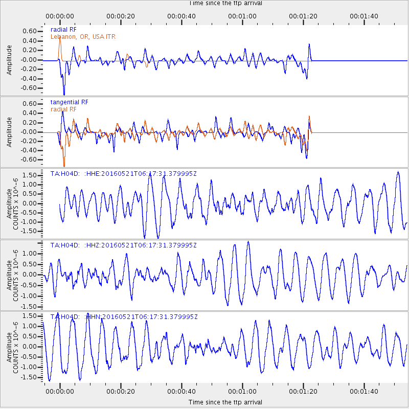
H04D Lebanon, OR, USA - Earthquake Result Viewer
*The percent match for this event was below the threshold and hence no stack was calculated.
| Earthquake location: |
Southeast Of Honshu, Japan |
| Earthquake latitude/longitude: |
30.9/140.1 |
| Earthquake time(UTC): |
2016/05/21 (142) 06:06:42 GMT |
| Earthquake Depth: |
130 km |
| Earthquake Magnitude: |
5.5 MB |
| Earthquake Catalog/Contributor: |
NEIC PDE/NEIC COMCAT |
|
| Network: |
TA USArray Transportable Network (new EarthScope stations) |
| Station: |
H04D Lebanon, OR, USA |
| Lat/Lon: |
44.52 N/122.74 W |
| Elevation: |
284 m |
|
| Distance: |
73.7 deg |
| Az: |
47.675 deg |
| Baz: |
297.361 deg |
| Ray Param: |
$rayparam |
*The percent match for this event was below the threshold and hence was not used in the summary stack. |
|
| Radial Match: |
80.77543 % |
| Radial Bump: |
400 |
| Transverse Match: |
65.29488 % |
| Transverse Bump: |
400 |
| SOD ConfigId: |
7422571 |
| Insert Time: |
2019-04-22 15:25:45.950 +0000 |
| GWidth: |
2.5 |
| Max Bumps: |
400 |
| Tol: |
0.001 |
|
Signal To Noise
| Channel | StoN | STA | LTA |
| TA:H04D: :HHZ:20160521T06:17:31.379995Z | 1.1075364 | 3.383193E-7 | 3.0547014E-7 |
| TA:H04D: :HHN:20160521T06:17:31.379995Z | 1.9040419 | 1.1486148E-6 | 6.0325084E-7 |
| TA:H04D: :HHE:20160521T06:17:31.379995Z | 2.317887 | 1.2088694E-6 | 5.215394E-7 |
| Arrivals |
| Ps | |
| PpPs | |
| PsPs/PpSs | |


