You are here: Home > Network List > TA - USArray Transportable Network (new EarthScope stations) Stations List
> Station M31M Drury Creek, Yukon, CA > Earthquake Result Viewer
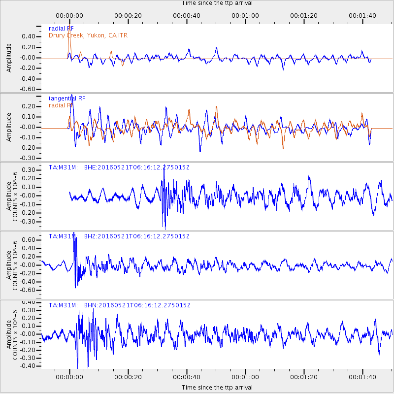
M31M Drury Creek, Yukon, CA - Earthquake Result Viewer
*The percent match for this event was below the threshold and hence no stack was calculated.
| Earthquake location: |
Southeast Of Honshu, Japan |
| Earthquake latitude/longitude: |
30.9/140.1 |
| Earthquake time(UTC): |
2016/05/21 (142) 06:06:42 GMT |
| Earthquake Depth: |
130 km |
| Earthquake Magnitude: |
5.5 MB |
| Earthquake Catalog/Contributor: |
NEIC PDE/NEIC COMCAT |
|
| Network: |
TA USArray Transportable Network (new EarthScope stations) |
| Station: |
M31M Drury Creek, Yukon, CA |
| Lat/Lon: |
62.20 N/134.39 W |
| Elevation: |
639 m |
|
| Distance: |
61.1 deg |
| Az: |
32.263 deg |
| Baz: |
281.922 deg |
| Ray Param: |
$rayparam |
*The percent match for this event was below the threshold and hence was not used in the summary stack. |
|
| Radial Match: |
53.685547 % |
| Radial Bump: |
400 |
| Transverse Match: |
58.515842 % |
| Transverse Bump: |
400 |
| SOD ConfigId: |
7422571 |
| Insert Time: |
2019-04-22 15:26:05.066 +0000 |
| GWidth: |
2.5 |
| Max Bumps: |
400 |
| Tol: |
0.001 |
|
Signal To Noise
| Channel | StoN | STA | LTA |
| TA:M31M: :BHZ:20160521T06:16:12.275015Z | 4.028557 | 2.9835186E-7 | 7.4059244E-8 |
| TA:M31M: :BHN:20160521T06:16:12.275015Z | 2.885728 | 1.17518674E-7 | 4.0724103E-8 |
| TA:M31M: :BHE:20160521T06:16:12.275015Z | 2.96522 | 1.3636786E-7 | 4.5989122E-8 |
| Arrivals |
| Ps | |
| PpPs | |
| PsPs/PpSs | |


