You are here: Home > Network List > TA - USArray Transportable Network (new EarthScope stations) Stations List
> Station MDND Maddock, ND, USA > Earthquake Result Viewer
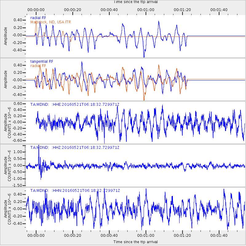
MDND Maddock, ND, USA - Earthquake Result Viewer
*The percent match for this event was below the threshold and hence no stack was calculated.
| Earthquake location: |
Southeast Of Honshu, Japan |
| Earthquake latitude/longitude: |
30.9/140.1 |
| Earthquake time(UTC): |
2016/05/21 (142) 06:06:42 GMT |
| Earthquake Depth: |
130 km |
| Earthquake Magnitude: |
5.5 MB |
| Earthquake Catalog/Contributor: |
NEIC PDE/NEIC COMCAT |
|
| Network: |
TA USArray Transportable Network (new EarthScope stations) |
| Station: |
MDND Maddock, ND, USA |
| Lat/Lon: |
47.85 N/99.60 W |
| Elevation: |
479 m |
|
| Distance: |
85.1 deg |
| Az: |
35.697 deg |
| Baz: |
311.895 deg |
| Ray Param: |
$rayparam |
*The percent match for this event was below the threshold and hence was not used in the summary stack. |
|
| Radial Match: |
50.849277 % |
| Radial Bump: |
338 |
| Transverse Match: |
50.59135 % |
| Transverse Bump: |
400 |
| SOD ConfigId: |
7422571 |
| Insert Time: |
2019-04-22 15:26:05.479 +0000 |
| GWidth: |
2.5 |
| Max Bumps: |
400 |
| Tol: |
0.001 |
|
Signal To Noise
| Channel | StoN | STA | LTA |
| TA:MDND: :HHZ:20160521T06:18:32.729971Z | 3.6567025 | 3.9340728E-7 | 1.0758525E-7 |
| TA:MDND: :HHN:20160521T06:18:32.729971Z | 0.68106765 | 1.7085816E-7 | 2.508681E-7 |
| TA:MDND: :HHE:20160521T06:18:32.729971Z | 1.6020108 | 2.1005864E-7 | 1.3112187E-7 |
| Arrivals |
| Ps | |
| PpPs | |
| PsPs/PpSs | |


