You are here: Home > Network List > TA - USArray Transportable Network (new EarthScope stations) Stations List
> Station R11A Troy Canyon, Currant, NV, USA > Earthquake Result Viewer
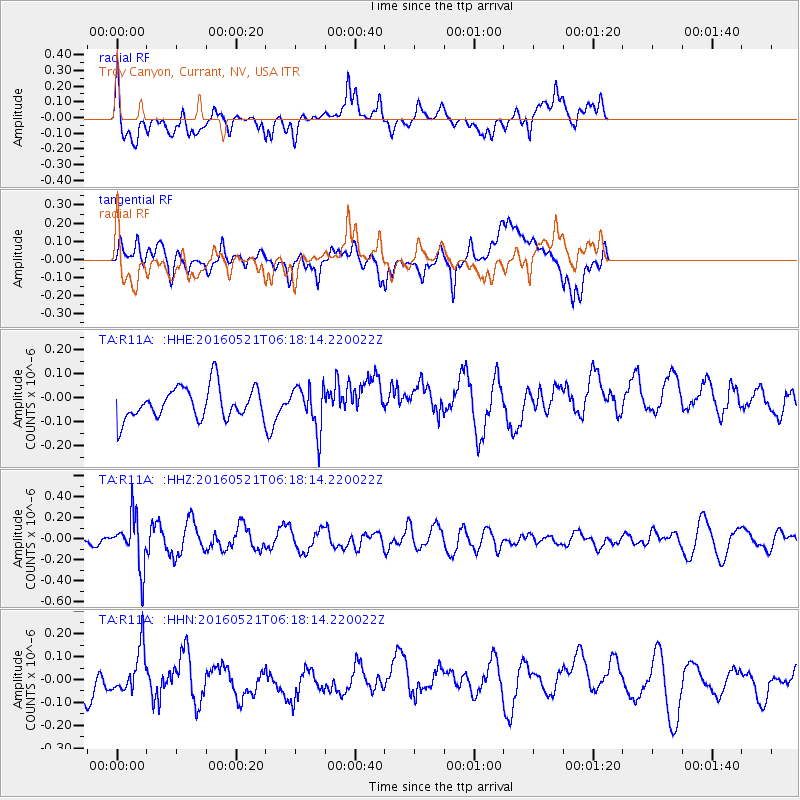
R11A Troy Canyon, Currant, NV, USA - Earthquake Result Viewer
*The percent match for this event was below the threshold and hence no stack was calculated.
| Earthquake location: |
Southeast Of Honshu, Japan |
| Earthquake latitude/longitude: |
30.9/140.1 |
| Earthquake time(UTC): |
2016/05/21 (142) 06:06:42 GMT |
| Earthquake Depth: |
130 km |
| Earthquake Magnitude: |
5.5 MB |
| Earthquake Catalog/Contributor: |
NEIC PDE/NEIC COMCAT |
|
| Network: |
TA USArray Transportable Network (new EarthScope stations) |
| Station: |
R11A Troy Canyon, Currant, NV, USA |
| Lat/Lon: |
38.35 N/115.59 W |
| Elevation: |
1756 m |
|
| Distance: |
81.5 deg |
| Az: |
50.379 deg |
| Baz: |
302.669 deg |
| Ray Param: |
$rayparam |
*The percent match for this event was below the threshold and hence was not used in the summary stack. |
|
| Radial Match: |
63.28018 % |
| Radial Bump: |
400 |
| Transverse Match: |
54.800026 % |
| Transverse Bump: |
400 |
| SOD ConfigId: |
7422571 |
| Insert Time: |
2019-04-22 15:26:18.303 +0000 |
| GWidth: |
2.5 |
| Max Bumps: |
400 |
| Tol: |
0.001 |
|
Signal To Noise
| Channel | StoN | STA | LTA |
| TA:R11A: :HHZ:20160521T06:18:14.220022Z | 5.5780244 | 2.4340943E-7 | 4.3637215E-8 |
| TA:R11A: :HHN:20160521T06:18:14.220022Z | 1.4489357 | 9.383141E-8 | 6.475885E-8 |
| TA:R11A: :HHE:20160521T06:18:14.220022Z | 1.3729782 | 8.9505306E-8 | 6.5190626E-8 |
| Arrivals |
| Ps | |
| PpPs | |
| PsPs/PpSs | |


