You are here: Home > Network List > TA - USArray Transportable Network (new EarthScope stations) Stations List
> Station TPFO Pinon Flats, CA, USA > Earthquake Result Viewer
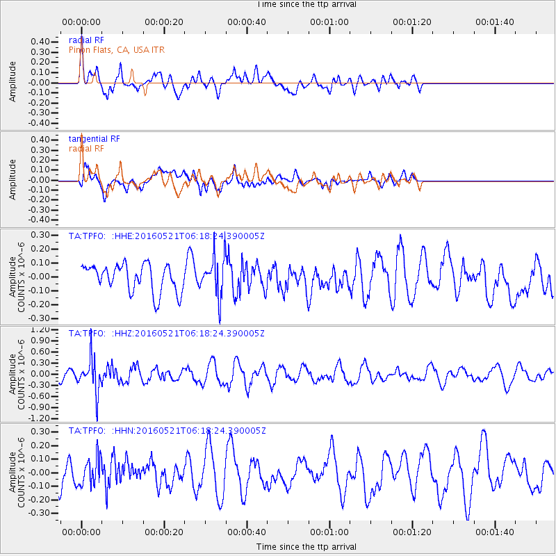
TPFO Pinon Flats, CA, USA - Earthquake Result Viewer
*The percent match for this event was below the threshold and hence no stack was calculated.
| Earthquake location: |
Southeast Of Honshu, Japan |
| Earthquake latitude/longitude: |
30.9/140.1 |
| Earthquake time(UTC): |
2016/05/21 (142) 06:06:42 GMT |
| Earthquake Depth: |
130 km |
| Earthquake Magnitude: |
5.5 MB |
| Earthquake Catalog/Contributor: |
NEIC PDE/NEIC COMCAT |
|
| Network: |
TA USArray Transportable Network (new EarthScope stations) |
| Station: |
TPFO Pinon Flats, CA, USA |
| Lat/Lon: |
33.61 N/116.45 W |
| Elevation: |
1275 m |
|
| Distance: |
83.4 deg |
| Az: |
54.78 deg |
| Baz: |
302.74 deg |
| Ray Param: |
$rayparam |
*The percent match for this event was below the threshold and hence was not used in the summary stack. |
|
| Radial Match: |
61.89589 % |
| Radial Bump: |
400 |
| Transverse Match: |
76.92324 % |
| Transverse Bump: |
400 |
| SOD ConfigId: |
7422571 |
| Insert Time: |
2019-04-22 15:26:22.971 +0000 |
| GWidth: |
2.5 |
| Max Bumps: |
400 |
| Tol: |
0.001 |
|
Signal To Noise
| Channel | StoN | STA | LTA |
| TA:TPFO: :HHZ:20160521T06:18:24.390005Z | 2.4056082 | 4.4256998E-7 | 1.8397427E-7 |
| TA:TPFO: :HHN:20160521T06:18:24.390005Z | 0.96514726 | 1.04636435E-7 | 1.08415E-7 |
| TA:TPFO: :HHE:20160521T06:18:24.390005Z | 1.343245 | 1.3379452E-7 | 9.9605444E-8 |
| Arrivals |
| Ps | |
| PpPs | |
| PsPs/PpSs | |


