You are here: Home > Network List > TA - USArray Transportable Network (new EarthScope stations) Stations List
> Station W41B Gary Mavity, Velonia, AR, USA > Earthquake Result Viewer
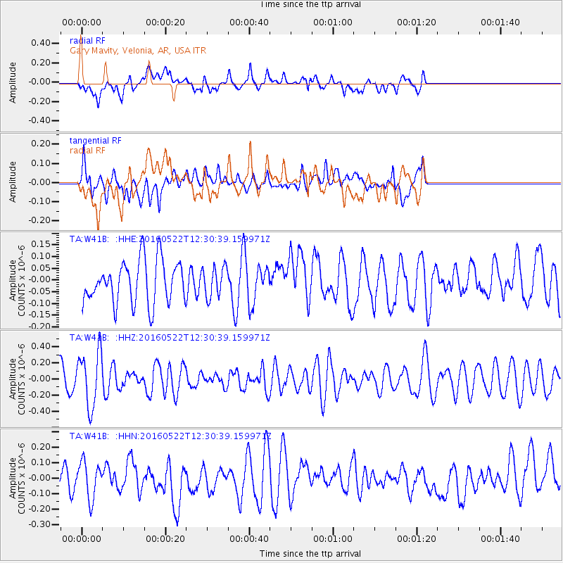
W41B Gary Mavity, Velonia, AR, USA - Earthquake Result Viewer
*The percent match for this event was below the threshold and hence no stack was calculated.
| Earthquake location: |
Salta Province, Argentina |
| Earthquake latitude/longitude: |
-22.4/-64.2 |
| Earthquake time(UTC): |
2016/05/22 (143) 12:20:42 GMT |
| Earthquake Depth: |
9.2 km |
| Earthquake Magnitude: |
5.5 MB |
| Earthquake Catalog/Contributor: |
NEIC PDE/NEIC COMCAT |
|
| Network: |
TA USArray Transportable Network (new EarthScope stations) |
| Station: |
W41B Gary Mavity, Velonia, AR, USA |
| Lat/Lon: |
35.17 N/92.25 W |
| Elevation: |
95 m |
|
| Distance: |
63.1 deg |
| Az: |
334.419 deg |
| Baz: |
150.802 deg |
| Ray Param: |
$rayparam |
*The percent match for this event was below the threshold and hence was not used in the summary stack. |
|
| Radial Match: |
53.385345 % |
| Radial Bump: |
400 |
| Transverse Match: |
62.74388 % |
| Transverse Bump: |
400 |
| SOD ConfigId: |
7422571 |
| Insert Time: |
2019-04-22 15:35:36.245 +0000 |
| GWidth: |
2.5 |
| Max Bumps: |
400 |
| Tol: |
0.001 |
|
Signal To Noise
| Channel | StoN | STA | LTA |
| TA:W41B: :HHZ:20160522T12:30:39.159971Z | 2.326927 | 3.517979E-7 | 1.5118562E-7 |
| TA:W41B: :HHN:20160522T12:30:39.159971Z | 1.4147902 | 1.2019338E-7 | 8.495492E-8 |
| TA:W41B: :HHE:20160522T12:30:39.159971Z | 0.6922855 | 6.279485E-8 | 9.070658E-8 |
| Arrivals |
| Ps | |
| PpPs | |
| PsPs/PpSs | |


