You are here: Home > Network List > TA - USArray Transportable Network (new EarthScope stations) Stations List
> Station Z41A Richland Creek Farm, El Dorado, AR, USA > Earthquake Result Viewer
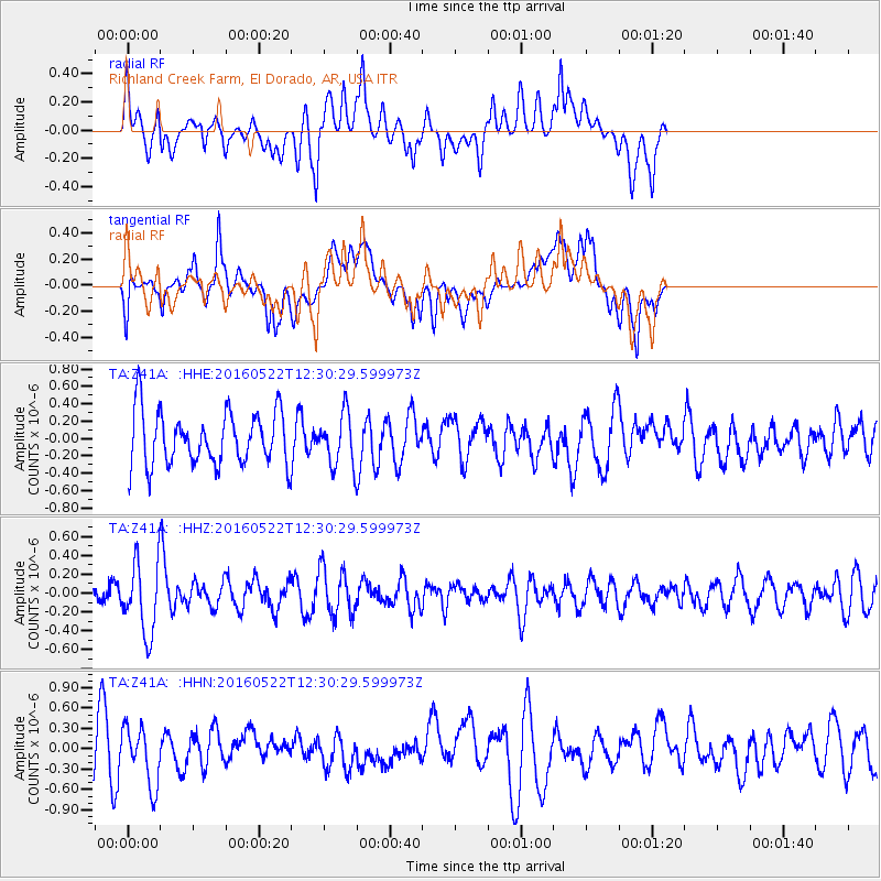
Z41A Richland Creek Farm, El Dorado, AR, USA - Earthquake Result Viewer
*The percent match for this event was below the threshold and hence no stack was calculated.
| Earthquake location: |
Salta Province, Argentina |
| Earthquake latitude/longitude: |
-22.4/-64.2 |
| Earthquake time(UTC): |
2016/05/22 (143) 12:20:42 GMT |
| Earthquake Depth: |
9.2 km |
| Earthquake Magnitude: |
5.5 MB |
| Earthquake Catalog/Contributor: |
NEIC PDE/NEIC COMCAT |
|
| Network: |
TA USArray Transportable Network (new EarthScope stations) |
| Station: |
Z41A Richland Creek Farm, El Dorado, AR, USA |
| Lat/Lon: |
33.26 N/92.80 W |
| Elevation: |
62 m |
|
| Distance: |
61.7 deg |
| Az: |
332.9 deg |
| Baz: |
149.787 deg |
| Ray Param: |
$rayparam |
*The percent match for this event was below the threshold and hence was not used in the summary stack. |
|
| Radial Match: |
43.980553 % |
| Radial Bump: |
400 |
| Transverse Match: |
40.955402 % |
| Transverse Bump: |
400 |
| SOD ConfigId: |
7422571 |
| Insert Time: |
2019-04-22 15:35:40.230 +0000 |
| GWidth: |
2.5 |
| Max Bumps: |
400 |
| Tol: |
0.001 |
|
Signal To Noise
| Channel | StoN | STA | LTA |
| TA:Z41A: :HHZ:20160522T12:30:29.599973Z | 2.4515533 | 3.932805E-7 | 1.6042094E-7 |
| TA:Z41A: :HHN:20160522T12:30:29.599973Z | 1.3631085 | 4.2812246E-7 | 3.1407805E-7 |
| TA:Z41A: :HHE:20160522T12:30:29.599973Z | 1.0714182 | 3.2708462E-7 | 3.0528193E-7 |
| Arrivals |
| Ps | |
| PpPs | |
| PsPs/PpSs | |


