NEE2 Needles Airport - Earthquake Result Viewer
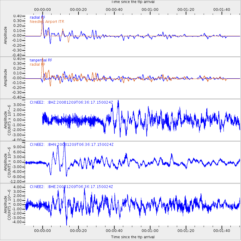
Earthquake location: Kermadec Islands Region
Earthquake latitude/longitude: -31.2/-176.9
Earthquake time(UTC): 2008/12/09 (344) 06:23:59 GMT
Earthquake Depth: 18 km
Earthquake Magnitude: 6.2 MB, 6.7 MS, 6.8 MW, 6.7 MW
Earthquake Catalog/Contributor: WHDF/NEIC
Network: CI Caltech Regional Seismic Network
Station: NEE2 Needles Airport
Lat/Lon: 34.77 N/114.62 W
Elevation: 271 m
Distance: 88.0 deg
Az: 46.835 deg
Baz: 229.371 deg
Ray Param: 0.042896926
Estimated Moho Depth: 20.0 km
Estimated Crust Vp/Vs: 1.60
Assumed Crust Vp: 6.276 km/s
Estimated Crust Vs: 3.922 km/s
Estimated Crust Poisson's Ratio: 0.18
Radial Match: 93.69925 %
Radial Bump: 400
Transverse Match: 85.95205 %
Transverse Bump: 400
SOD ConfigId: 2658
Insert Time: 2010-02-26 00:23:33.201 +0000
GWidth: 2.5
Max Bumps: 400
Tol: 0.001

Signal To Noise

ChannelStoNSTALTA
CI:NEE2: :BHN:20081209T06:36:17.150024Z5.3752792.6394805E-64.910406E-7
CI:NEE2: :BHE:20081209T06:36:17.150024Z1.61392098.78101E-75.4407934E-7
CI:NEE2: :BHZ:20081209T06:36:17.150024Z1.42074998.0622317E-75.6746313E-7
Arrivals
Ps2.0 SECOND
PpPs8.1 SECOND
PsPs/PpSs10 SECOND