You are here: Home > Network List > AZ - ANZA Regional Network Stations List
> Station SMER AZ.SMER > Earthquake Result Viewer
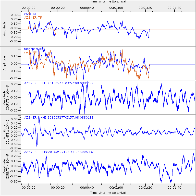
SMER AZ.SMER - Earthquake Result Viewer
*The percent match for this event was below the threshold and hence no stack was calculated.
| Earthquake location: |
Southeast Of Ryukyu Islands |
| Earthquake latitude/longitude: |
27.0/130.2 |
| Earthquake time(UTC): |
2016/05/27 (148) 03:44:29 GMT |
| Earthquake Depth: |
10 km |
| Earthquake Magnitude: |
5.8 MO |
| Earthquake Catalog/Contributor: |
NEIC PDE/NEIC ALERT |
|
| Network: |
AZ ANZA Regional Network |
| Station: |
SMER AZ.SMER |
| Lat/Lon: |
33.46 N/117.17 W |
| Elevation: |
355 m |
|
| Distance: |
92.3 deg |
| Az: |
50.552 deg |
| Baz: |
304.487 deg |
| Ray Param: |
$rayparam |
*The percent match for this event was below the threshold and hence was not used in the summary stack. |
|
| Radial Match: |
60.265945 % |
| Radial Bump: |
400 |
| Transverse Match: |
60.816765 % |
| Transverse Bump: |
400 |
| SOD ConfigId: |
7422571 |
| Insert Time: |
2019-04-22 15:49:38.575 +0000 |
| GWidth: |
2.5 |
| Max Bumps: |
400 |
| Tol: |
0.001 |
|
Signal To Noise
| Channel | StoN | STA | LTA |
| AZ:SMER: :HHZ:20160527T03:57:08.088013Z | 3.0522134 | 1.9001392E-7 | 6.2254465E-8 |
| AZ:SMER: :HHN:20160527T03:57:08.088013Z | 0.9454318 | 7.139974E-8 | 7.552077E-8 |
| AZ:SMER: :HHE:20160527T03:57:08.088013Z | 0.9751359 | 6.2350885E-8 | 6.394072E-8 |
| Arrivals |
| Ps | |
| PpPs | |
| PsPs/PpSs | |


