You are here: Home > Network List > CI - Caltech Regional Seismic Network Stations List
> Station BAR Barrett, Tecate, CA, USA > Earthquake Result Viewer
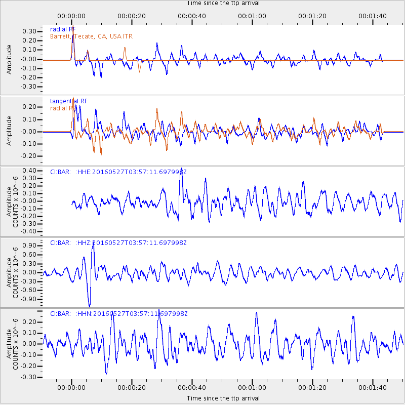
BAR Barrett, Tecate, CA, USA - Earthquake Result Viewer
*The percent match for this event was below the threshold and hence no stack was calculated.
| Earthquake location: |
Southeast Of Ryukyu Islands |
| Earthquake latitude/longitude: |
27.0/130.2 |
| Earthquake time(UTC): |
2016/05/27 (148) 03:44:29 GMT |
| Earthquake Depth: |
10 km |
| Earthquake Magnitude: |
5.8 MO |
| Earthquake Catalog/Contributor: |
NEIC PDE/NEIC ALERT |
|
| Network: |
CI Caltech Regional Seismic Network |
| Station: |
BAR Barrett, Tecate, CA, USA |
| Lat/Lon: |
32.68 N/116.67 W |
| Elevation: |
521 m |
|
| Distance: |
93.0 deg |
| Az: |
50.953 deg |
| Baz: |
304.74 deg |
| Ray Param: |
$rayparam |
*The percent match for this event was below the threshold and hence was not used in the summary stack. |
|
| Radial Match: |
63.787457 % |
| Radial Bump: |
378 |
| Transverse Match: |
71.56901 % |
| Transverse Bump: |
400 |
| SOD ConfigId: |
7422571 |
| Insert Time: |
2019-04-22 15:50:12.781 +0000 |
| GWidth: |
2.5 |
| Max Bumps: |
400 |
| Tol: |
0.001 |
|
Signal To Noise
| Channel | StoN | STA | LTA |
| CI:BAR: :HHZ:20160527T03:57:11.697998Z | 2.6321094 | 2.4590082E-7 | 9.342347E-8 |
| CI:BAR: :HHN:20160527T03:57:11.697998Z | 0.812155 | 6.8363924E-8 | 8.417596E-8 |
| CI:BAR: :HHE:20160527T03:57:11.697998Z | 1.7928256 | 1.13585585E-7 | 6.335562E-8 |
| Arrivals |
| Ps | |
| PpPs | |
| PsPs/PpSs | |


