You are here: Home > Network List > CI - Caltech Regional Seismic Network Stations List
> Station MUR Murrieta > Earthquake Result Viewer
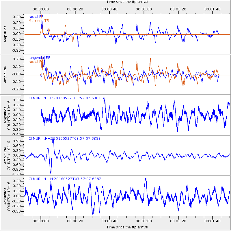
MUR Murrieta - Earthquake Result Viewer
*The percent match for this event was below the threshold and hence no stack was calculated.
| Earthquake location: |
Southeast Of Ryukyu Islands |
| Earthquake latitude/longitude: |
27.0/130.2 |
| Earthquake time(UTC): |
2016/05/27 (148) 03:44:29 GMT |
| Earthquake Depth: |
10 km |
| Earthquake Magnitude: |
5.8 MO |
| Earthquake Catalog/Contributor: |
NEIC PDE/NEIC ALERT |
|
| Network: |
CI Caltech Regional Seismic Network |
| Station: |
MUR Murrieta |
| Lat/Lon: |
33.60 N/117.20 W |
| Elevation: |
562 m |
|
| Distance: |
92.2 deg |
| Az: |
50.447 deg |
| Baz: |
304.478 deg |
| Ray Param: |
$rayparam |
*The percent match for this event was below the threshold and hence was not used in the summary stack. |
|
| Radial Match: |
66.676025 % |
| Radial Bump: |
400 |
| Transverse Match: |
70.06003 % |
| Transverse Bump: |
400 |
| SOD ConfigId: |
7422571 |
| Insert Time: |
2019-04-22 15:50:34.941 +0000 |
| GWidth: |
2.5 |
| Max Bumps: |
400 |
| Tol: |
0.001 |
|
Signal To Noise
| Channel | StoN | STA | LTA |
| CI:MUR: :HHZ:20160527T03:57:07.638Z | 2.7206569 | 2.194931E-7 | 8.0676514E-8 |
| CI:MUR: :HHN:20160527T03:57:07.638Z | 1.1736912 | 8.602819E-8 | 7.329712E-8 |
| CI:MUR: :HHE:20160527T03:57:07.638Z | 0.713896 | 6.450271E-8 | 9.03531E-8 |
| Arrivals |
| Ps | |
| PpPs | |
| PsPs/PpSs | |


