You are here: Home > Network List > TA - USArray Transportable Network (new EarthScope stations) Stations List
> Station J05D Fort Rock, OR, USA > Earthquake Result Viewer
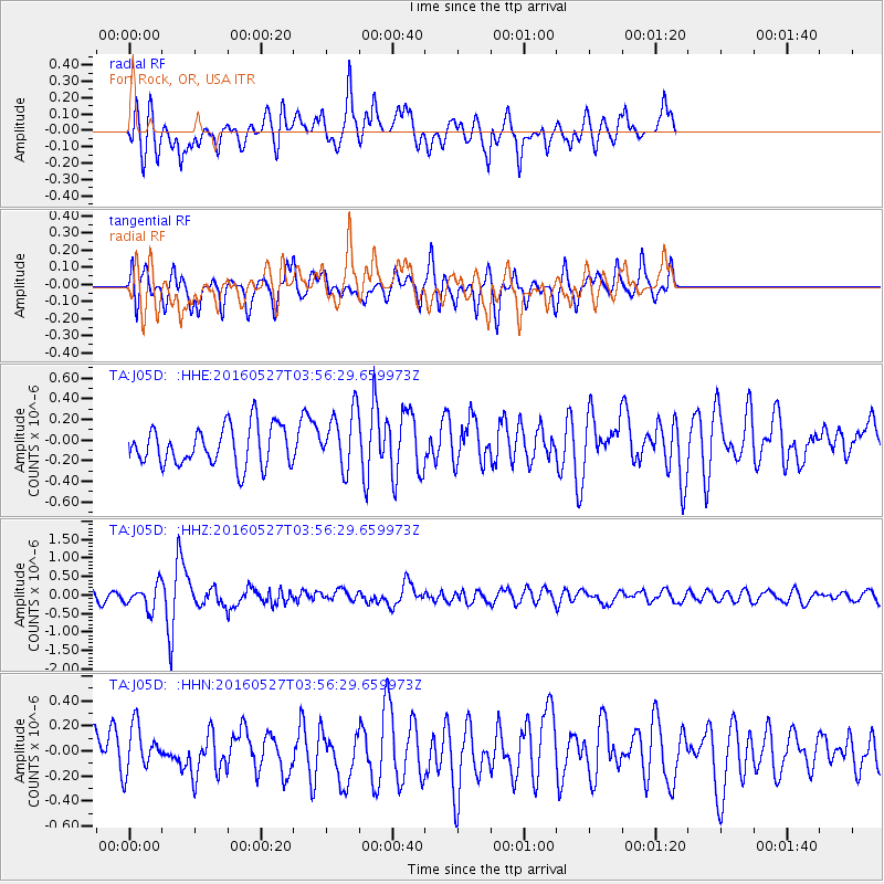
J05D Fort Rock, OR, USA - Earthquake Result Viewer
*The percent match for this event was below the threshold and hence no stack was calculated.
| Earthquake location: |
Southeast Of Ryukyu Islands |
| Earthquake latitude/longitude: |
27.0/130.2 |
| Earthquake time(UTC): |
2016/05/27 (148) 03:44:29 GMT |
| Earthquake Depth: |
10 km |
| Earthquake Magnitude: |
5.8 MO |
| Earthquake Catalog/Contributor: |
NEIC PDE/NEIC ALERT |
|
| Network: |
TA USArray Transportable Network (new EarthScope stations) |
| Station: |
J05D Fort Rock, OR, USA |
| Lat/Lon: |
43.28 N/121.23 W |
| Elevation: |
1541 m |
|
| Distance: |
84.2 deg |
| Az: |
44.089 deg |
| Baz: |
301.765 deg |
| Ray Param: |
$rayparam |
*The percent match for this event was below the threshold and hence was not used in the summary stack. |
|
| Radial Match: |
70.41858 % |
| Radial Bump: |
394 |
| Transverse Match: |
64.06102 % |
| Transverse Bump: |
400 |
| SOD ConfigId: |
7422571 |
| Insert Time: |
2019-04-22 15:55:21.666 +0000 |
| GWidth: |
2.5 |
| Max Bumps: |
400 |
| Tol: |
0.001 |
|
Signal To Noise
| Channel | StoN | STA | LTA |
| TA:J05D: :HHZ:20160527T03:56:29.659973Z | 2.4584405 | 3.2653261E-7 | 1.3282103E-7 |
| TA:J05D: :HHN:20160527T03:56:29.659973Z | 1.102357 | 1.8976948E-7 | 1.7214884E-7 |
| TA:J05D: :HHE:20160527T03:56:29.659973Z | 1.2457913 | 2.3579152E-7 | 1.8927048E-7 |
| Arrivals |
| Ps | |
| PpPs | |
| PsPs/PpSs | |


