You are here: Home > Network List > TA - USArray Transportable Network (new EarthScope stations) Stations List
> Station MDND Maddock, ND, USA > Earthquake Result Viewer
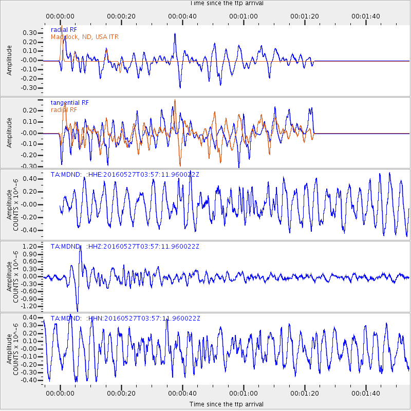
MDND Maddock, ND, USA - Earthquake Result Viewer
*The percent match for this event was below the threshold and hence no stack was calculated.
| Earthquake location: |
Southeast Of Ryukyu Islands |
| Earthquake latitude/longitude: |
27.0/130.2 |
| Earthquake time(UTC): |
2016/05/27 (148) 03:44:29 GMT |
| Earthquake Depth: |
10 km |
| Earthquake Magnitude: |
5.8 MO |
| Earthquake Catalog/Contributor: |
NEIC PDE/NEIC ALERT |
|
| Network: |
TA USArray Transportable Network (new EarthScope stations) |
| Station: |
MDND Maddock, ND, USA |
| Lat/Lon: |
47.85 N/99.60 W |
| Elevation: |
479 m |
|
| Distance: |
93.1 deg |
| Az: |
31.012 deg |
| Baz: |
316.956 deg |
| Ray Param: |
$rayparam |
*The percent match for this event was below the threshold and hence was not used in the summary stack. |
|
| Radial Match: |
53.369156 % |
| Radial Bump: |
369 |
| Transverse Match: |
68.851776 % |
| Transverse Bump: |
343 |
| SOD ConfigId: |
7422571 |
| Insert Time: |
2019-04-22 15:55:38.627 +0000 |
| GWidth: |
2.5 |
| Max Bumps: |
400 |
| Tol: |
0.001 |
|
Signal To Noise
| Channel | StoN | STA | LTA |
| TA:MDND: :HHZ:20160527T03:57:11.960022Z | 2.8974984 | 2.1825674E-7 | 7.532592E-8 |
| TA:MDND: :HHN:20160527T03:57:11.960022Z | 1.5702703 | 2.2688837E-7 | 1.4449E-7 |
| TA:MDND: :HHE:20160527T03:57:11.960022Z | 1.3144053 | 2.6195403E-7 | 1.992947E-7 |
| Arrivals |
| Ps | |
| PpPs | |
| PsPs/PpSs | |


