You are here: Home > Network List > TJ - Tajikistan National Seismic Network Stations List
> Station GARM Garm, Tajikistan > Earthquake Result Viewer
GARM Garm, Tajikistan - Earthquake Result Viewer
*The percent match for this event was below the threshold and hence no stack was calculated.
| Earthquake location: |
Southeast Of Ryukyu Islands |
| Earthquake latitude/longitude: |
27.0/130.2 |
| Earthquake time(UTC): |
2016/05/27 (148) 03:44:29 GMT |
| Earthquake Depth: |
10 km |
| Earthquake Magnitude: |
5.8 MO |
| Earthquake Catalog/Contributor: |
NEIC PDE/NEIC ALERT |
|
| Network: |
TJ Tajikistan National Seismic Network |
| Station: |
GARM Garm, Tajikistan |
| Lat/Lon: |
39.00 N/70.32 E |
| Elevation: |
1305 m |
|
| Distance: |
50.8 deg |
| Az: |
299.594 deg |
| Baz: |
84.741 deg |
| Ray Param: |
$rayparam |
*The percent match for this event was below the threshold and hence was not used in the summary stack. |
|
| Radial Match: |
66.50275 % |
| Radial Bump: |
400 |
| Transverse Match: |
71.76545 % |
| Transverse Bump: |
400 |
| SOD ConfigId: |
7422571 |
| Insert Time: |
2019-04-22 15:56:05.947 +0000 |
| GWidth: |
2.5 |
| Max Bumps: |
400 |
| Tol: |
0.001 |
|
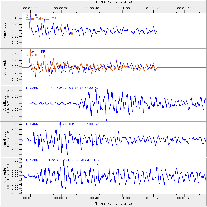
Signal To Noise
| Channel | StoN | STA | LTA |
| TJ:GARM: :HHZ:20160527T03:52:58.640015Z | 7.215941 | 6.704958E-7 | 9.291869E-8 |
| TJ:GARM: :HHN:20160527T03:52:58.640015Z | 1.1526864 | 1.0785852E-7 | 9.357144E-8 |
| TJ:GARM: :HHE:20160527T03:52:58.640015Z | 2.9356306 | 3.1023328E-7 | 1.0567857E-7 |
| Arrivals |
| Ps | |
| PpPs | |
| PsPs/PpSs | |


